Page 2 of 2

Re: Bicentennial National Trail

Posted: Fri Mar 02, 2012 2:40 am
by Meditator
Incidentally someone just told me they had the whole route on the vic section on GPS so if anyone wants a copy of that, contact BIG Nasty Track Michael on crazyguy.

Maybe the BNT people could do that.

Re: Bicentennial National Trail

Posted: Fri Mar 02, 2012 8:03 am
by WarrenH
Meditator wrote:Incidentally someone just told me they had the whole route on the vic section on GPS so if anyone wants a copy of that, contact BIG Nasty Track Michael on crazyguy.
There is no point in trying to trump the BNT Trail Coordinators ... they keep the trail route right up to date on the BNT site. What a rider rode last week will not necessarily be the trail this week.

Following the past rides of others, wont necessarily hold you in good stead nowadays. There are now 3 pages of track alterations for Guide Book 12 since Michael rode the track. The latest track updates have been posted on the BNT Site only 3 days ago. Likewise for Guide Book 11 there are updates.

I'll say it again, the BNT is a living trail. Changes to the trail can be forced on the trail by Mother Nature, forced upon the trail by properties changing hands, changes can be made to the trail by BNT coordinators making route improvements. The route improvements are mostly brought about to make the route safer for stock on the trail.

Warren.

Re: Bicentennial National Trail

Posted: Fri Mar 02, 2012 8:13 am
by trailgumby
Meditator wrote:$400 may be piddling to you, so send me some and the rest for all the postage required.
:lol: :lol: :lol:

I doubt you'd pass due diligence on our charitable giving program, but what the hey: what value to myself or others will you provide in exchange? ;)

Re: Bicentennial National Trail

Posted: Fri Mar 02, 2012 9:29 am
by silentbutdeadly
Meditator wrote: Anyhow silent, what tyres do you recommend for the journey? Have you ridden on Mondials? They are meant for off road as well on. On the basis of how tough i have found just the simple marathons (as well as the many recommendations), i've chosen to go with the mondials.

I mean in two outback trips (3000km around the kimberley and 2000 from cairns to darwin along the savanannah way (there are a lot of sharp rocks on that route), i've covered quite a bit of track that was really tough on tyres and they held up. I am thinking of taking them on one more trip on tar and then binning them.
The Marathon family of tyres are sensational touring tyres - you won't hear me diss them - they are as tough as old nails. But none of them are sufficiently aggressive tread wise for steep, wet, muddy East Coast fire trails. Have you tried climbing a steep, damp fire trail in your area? On a fully laden touring bike? What about descending? Any tyre slippage? Well the Mondial tread pattern isn't much more aggressive than the plain old Marathon. You might get some benefit from the Marathon MTB pattern but even that is quite an open tread....

Re: Bicentennial National Trail

Posted: Fri Mar 02, 2012 1:11 pm
by Meditator
The Marathon family of tyres are sensational touring tyres - you won't hear me diss them - they are as tough as old nails. But none of them are sufficiently aggressive tread wise for steep, wet, muddy East Coast fire trails. Have you tried climbing a steep, damp fire trail in your area? On a fully laden touring bike? What about descending? Any tyre slippage? Well the Mondial tread pattern isn't much more aggressive than the plain old Marathon. You might get some benefit from the Marathon MTB pattern but even that is quite an open tread....
I wouldn't be riding up a steep wet muddy fire trail. I would be pushing my bike. Riding down would be a different story. There's more to the tyre than the pattern though isn't there. Are you suggesting that it is possible to ride up such a hill with a loaded bike? Riding down, when the going is treacherous, i'd walk my bike down it.

Andy Friend told me by email that he used bontanger but didn't say which one. He still thinks they are good quality! But he went through 10 tyres which means less than 500 km per tyre. That's outrageous. It has to have been the wrong tyre for the route. It would be interesting to compare with others who've done the whole route. I wonder if he rode the XDX cause i saw a thread comparing these and it seemed to be about mountain biking. It was compared with the schwalbe racer one. (sorry can't go back to find right name. You might know it).

Re: Bicentennial National Trail

Posted: Tue Apr 30, 2013 5:46 pm
by tdm
L'iota wrote:G'day Meditator,
I have cycled with a supported group of 4 from Nowendoc to Nullo Mtn on a 6 day trip and several 1 day trips on other parts of the BNT in NSW. I also have done a 4WD reconnaissance of most of the BNT in NSW from the Qld border to Kancoban in preparation for future trips. I have a spreadsheet with fine detail of campsites, shops etc which may be of help to you.
Regardless of the cost (it goes to a good cause) The BNT Guidebook relevant to the particular section on which you are travelling is a MUST have. The more recent editions have much better maps.
The BNT is a great and varied ride with some long sections without major climbs.
L'iota
Hi L'iota,
Not sure if I can PM you, this is my first post here.
Any chance of you sharing the information that you mentioned above? I'm planning, with a few friends, on doing a section of the BNT from "somewhere west of Coffs Harbour to somewhere in SE Qld". This will probably be in late 2014, and we'll be taking a support vehicle. We have the guide books, but your on-the-ground info would be invaluable.
Thanks,
Paul.
tdm

Re: Bicentennial National Trail

Posted: Thu May 02, 2013 12:37 am
by WarrenH
I'm taking the train to Armidale next week. I'm riding/hiking/portaging the BNT Main Trail from Point Lookout, near Ebor, in the New England Ranges south to Canberra. If possible. I'm not going to take the alternate cycle routes, hopefully. After Georges Creek, is the real issue. If I can't cross the Macleay, at Little Georges and Macleay TSR, I'll head back towards Armidale. Then go back to the Macleay or maybe Kunderang by the shortest convenient route from the west. I'm allowing 6-7 weeks to do the Main Trail from New England to the ACT, including a few side trips.

I've been knocking out nearly 400 kilometres of hill climbing on the bike and about 40 kilometres of hill climbing on foot (jogging and walking) a week and about 10 hours in the gym each week, doing fast Tabarta style reps for my core, in prep for the ride/hikes/swims and portages. Done over the past 11 weeks. From tomorrow, until I head off, I'm upping the walking. It certainly takes a goodly amount of prep to take on the a BNT and to keep one's eye on the BOM's forecasts. The BOM is predicting a 75% chance of heavier than normal rainfall, for the next few months, on the Great Divide, in mid NSW. Ahh!, good water.

When I get back, I'll put a post on crazyguy called 'Riding from A to B' ... from Armidale to Belconnen. I'm still tossing up about having an alternate title too, called, 'Becoming a part of the Winter Wind'. ... or something stolen from Jimmy Ashcroft's iconic ballad about the wild New England Ranges, Little Boy Lost.

Warren.

Re: Bicentennial National Trail

Posted: Wed Jul 03, 2013 1:00 pm
by WarrenH
In my post above, I wrote that I was going to take the train to Armidale and then ride on the BNT back to Canberra. Country Link from 2 days ago, is now again called NSW Railways. NSW Railways had/has too many restrictions for me taking my bike, trailer and gear, particularly taking cooking gear, on the train, nor could they guarantee that if I posted my gear ahead, that I would even travel by train past Singleton and not have to change to coach travel. So I rode North.

Unfortunately, Mother Nature had alternate plans for me at almost every river, creek and low-level crossing on the route, after the first week. During the time that I was away, I had only 4 days when it didn't rain. Including 2 days of wind storms, with some huge gusts. One puff in the Southern Blue Mountains, ripped the trailer off the bike, when I was coasting downhill at about 35kph. It was the proverbial MTB yard sale.

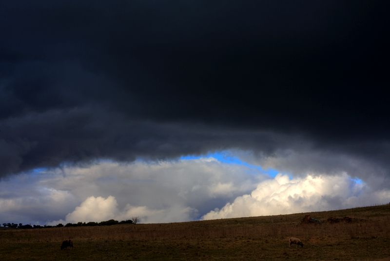
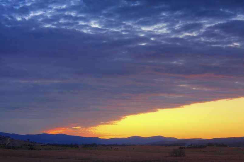
Over the last two weeks, travel was not efficiently possible, no matter how much backtracking I did, due to localised flooding ... the storms and winds from the 23 to 25 of June were extraordinary, giving massive dumps of rain and at times dustings of snow.

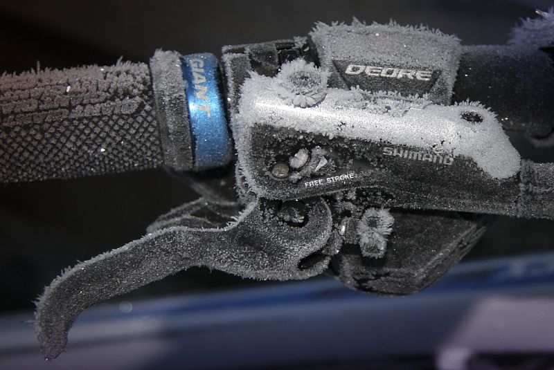
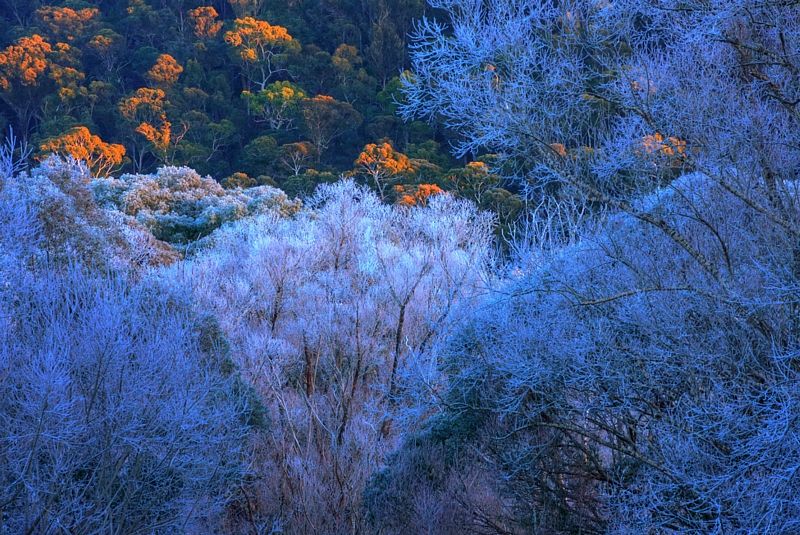
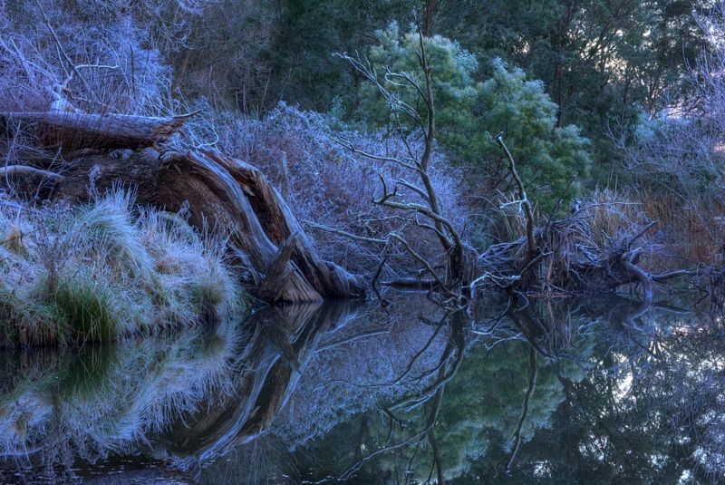
It was a good experience in tolerating discomfort and having the patience for late frosty starts. At times the temps at night dropped to at least -10°C, maybe even lower and the ice even in the sun didn't melt until mid morning. Not once did I loose sleep because of the cold at night, thanks to the Sea to Summit +8°C Thermolite Reactor, two silk inner-sheets both rated at +3°C, that I had in my -10°C sleeping bag.

I did a bit of exploring at times, off the BNT. Looking for old coach roads and lane ways. The biggest disappointment of the trip was on the way back. I headed East from Taralga to Bannaby, to ride the historic Swallow Tail Pass across the Tarlo River and several low level crossings and then take the Long Swamp Track through Tarlo River National Park. I turned around at the summit of Swallow Tail Pass and headed back to Taralgo, following the advice of a 4x4 driver who couldn't make the crossing. Then a couple of days later, I saw (many) huge logs being dragged out of the Tarlo River at Rayanna, and I was quite pleased that I didn't drop down through the steep Swallow Tail Pass, with a need for a difficult climb back out. If I can keep my fitness up, through this winter ... perhaps Swallow Tail Pass, is still the go, in a month or two.

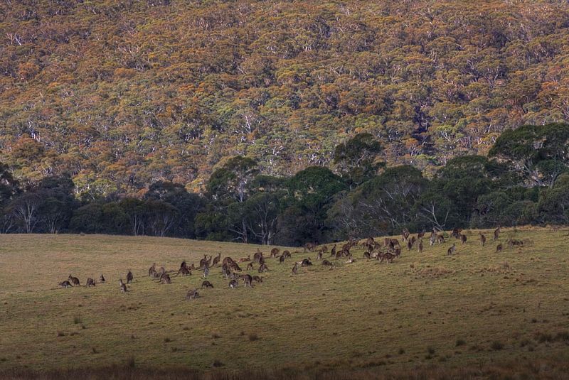
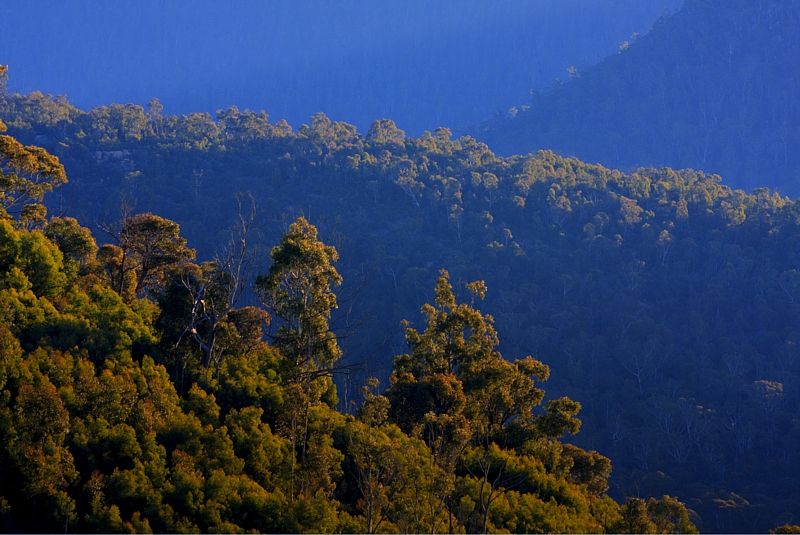
The highlight of the trip was at Hogans Flat, in the Southern Blue Mountains on the western edge of Mares Forest National Park. Heading down to Waiborough Creek near Mount Fatigue, I rode in a mob of 40-50 kangaroos for about 150 metres. I could have reached out with both hands and touched Roos within a metre of me, at any time. When I stopped to photograph them, they stopped ... but by the time that I got my camera out of the back pack, they were gone ... but not too far.

Image

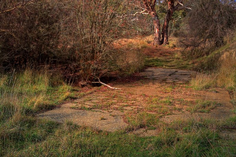
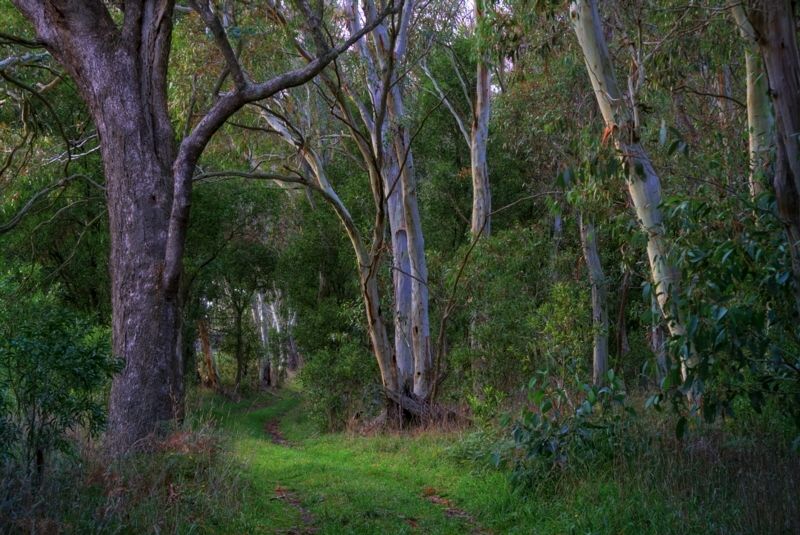
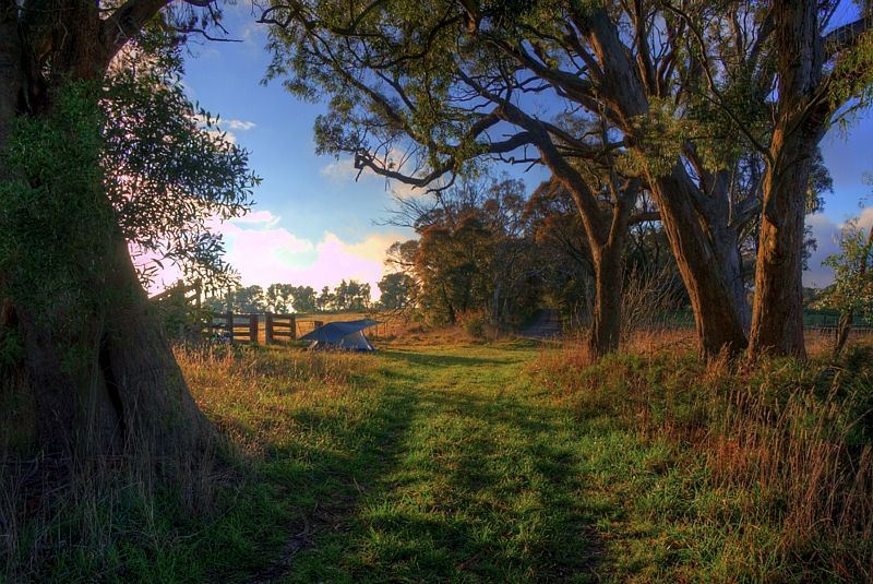
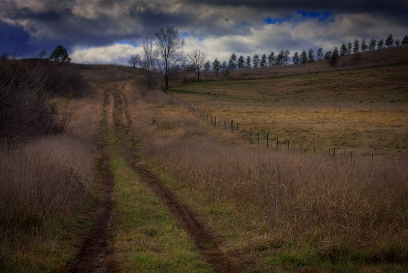
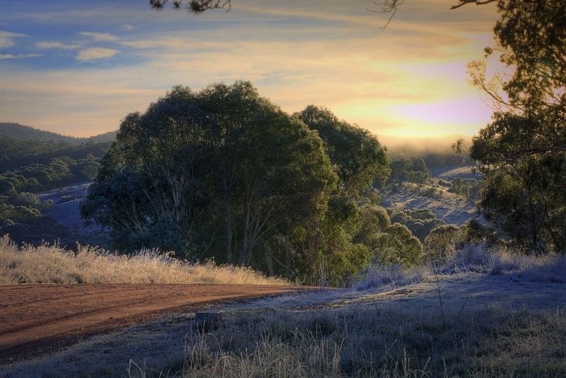
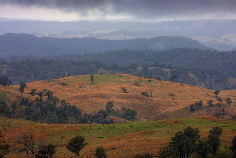
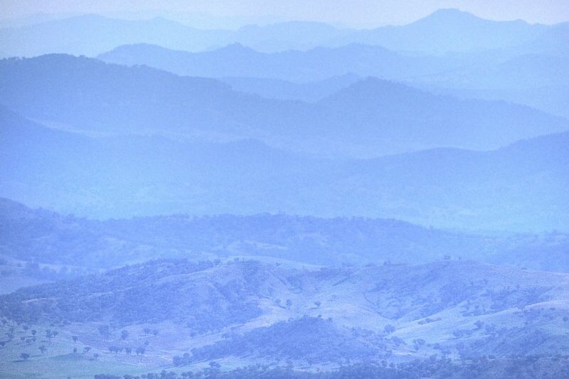
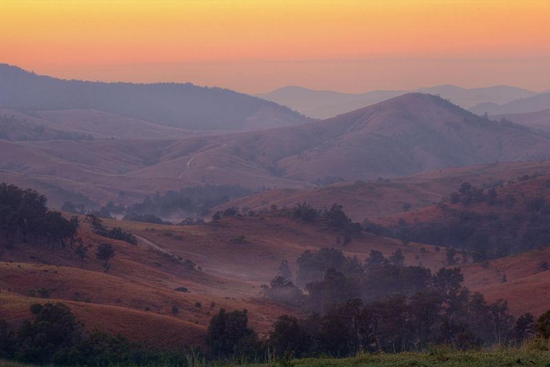
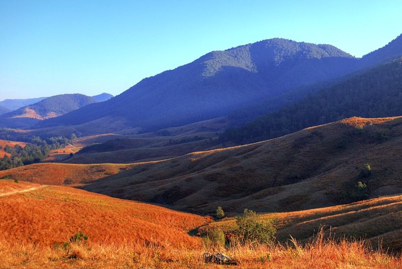
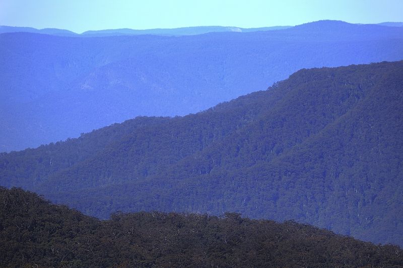
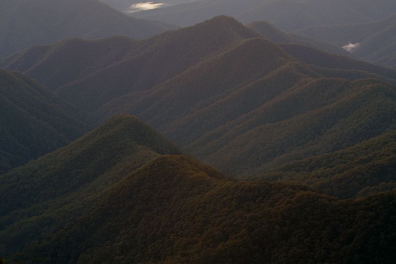
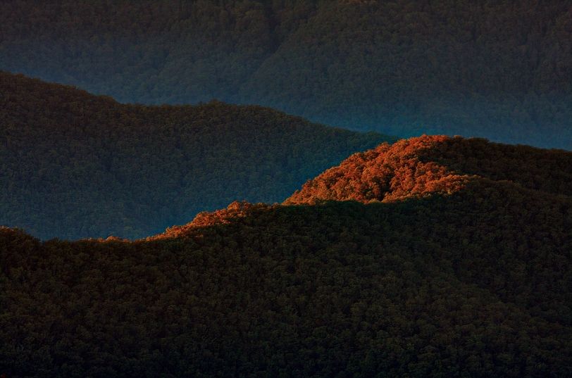
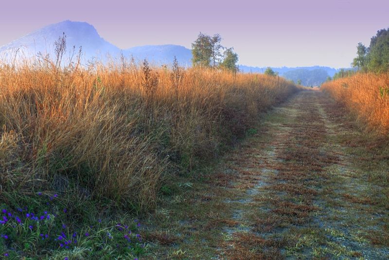
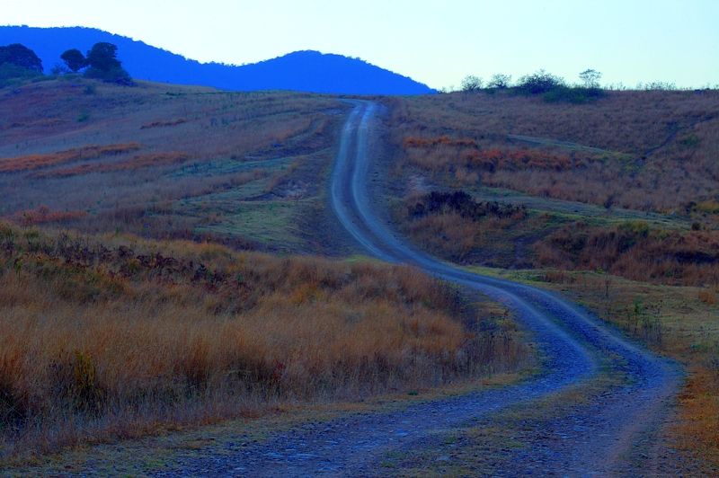
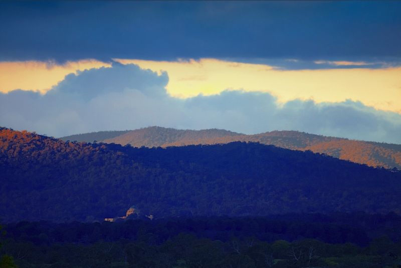
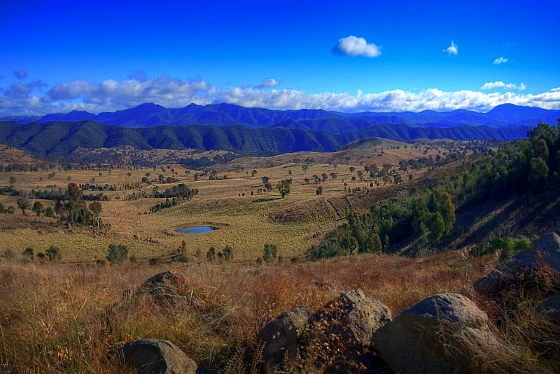
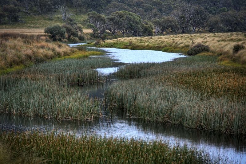
Some track shots. At Broken Bridge, at Willigam Hill, heading for Mount Rae, at Camerons Creek and slip-sliding into Taralga from Richlands.

Image

Image

Image

Image

Image

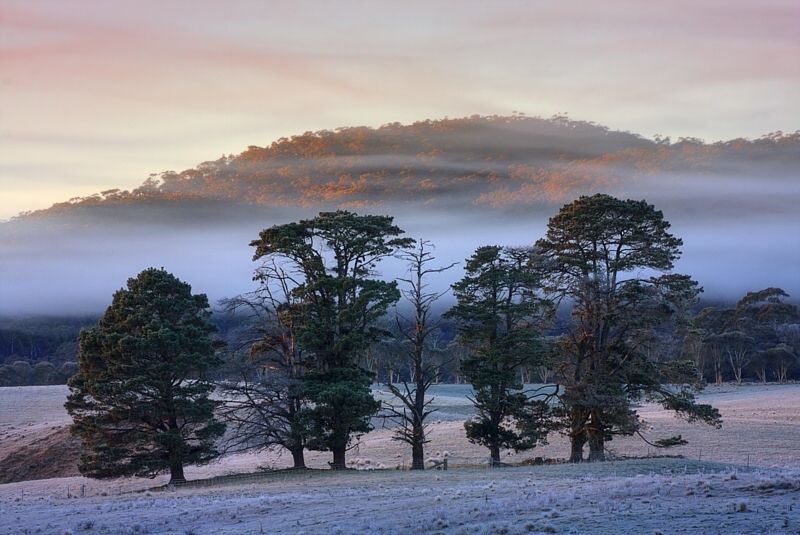
It was frosty at times especially on the bits ... and the bike got cold too.

Image

Image

Image

Image

The dark shape on the side of the trail is one of the polished black granite trail markers, that has GPS co-ordinates and a dedication.

Image

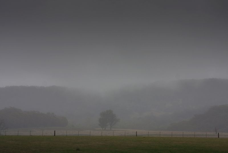
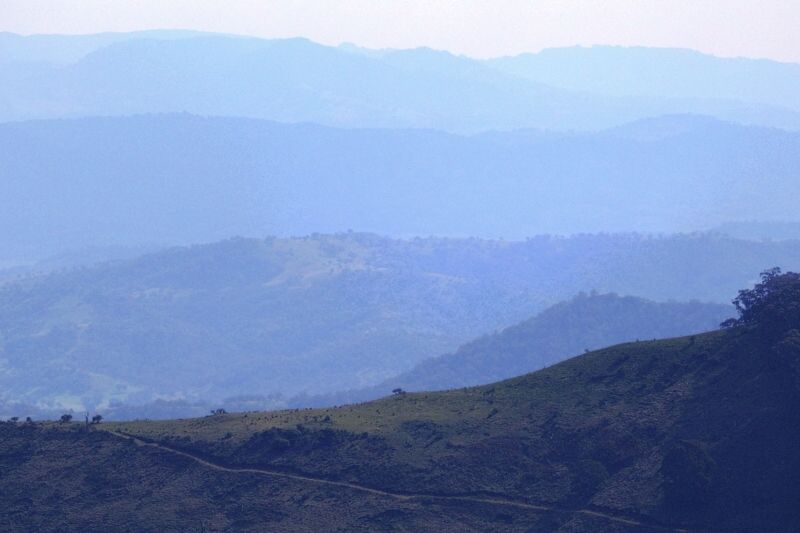
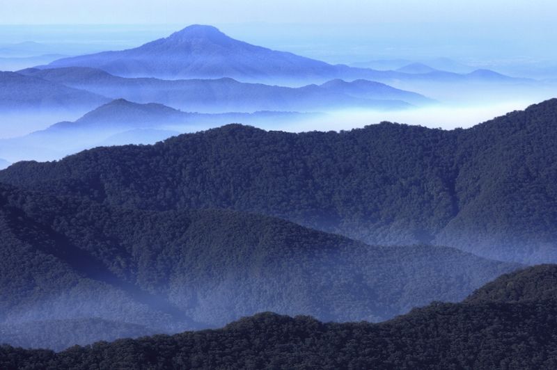
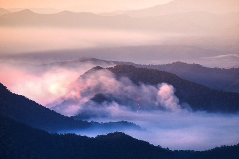
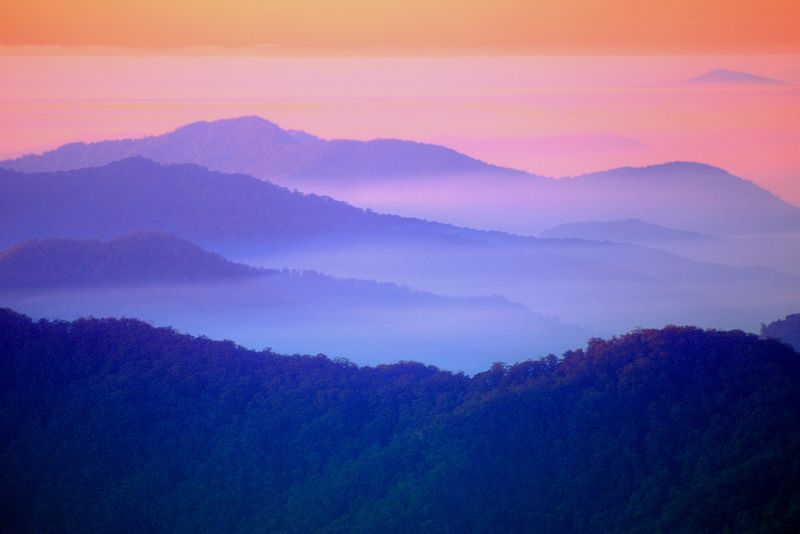
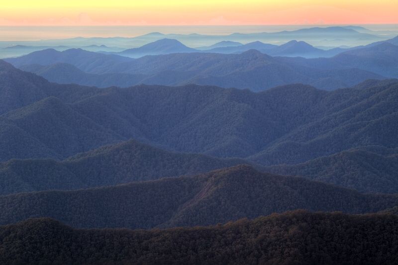
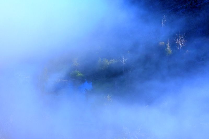
A looming storm on a high plateau of the Great Divide, in a valley beside the Bannaby Range and looking towards the Cockbundoon Ranges above the Tarlo River ... waiting for more rain. Outside one of the huts, where I held up for several days because of the storms, there was a 25lt plastic bucket, away from the hut. On the evening of the 24th and during the following day on the 25th of June, the bucket filled to overflowing, from empty. From what I can gather, now that I'm back home, SE NSW took a hammering then, from Mother Nature.

Image

Image

Image

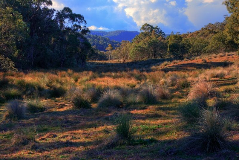
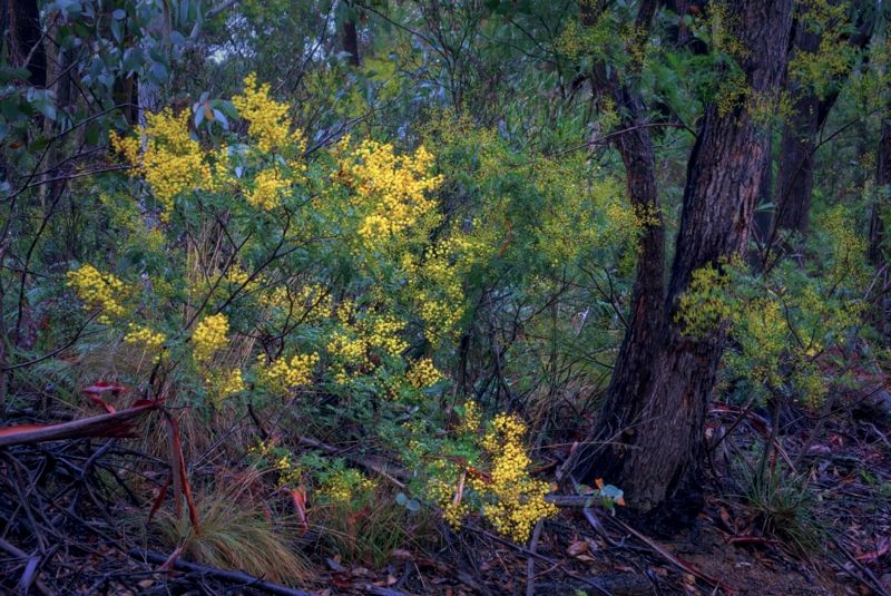
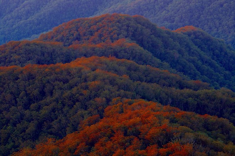
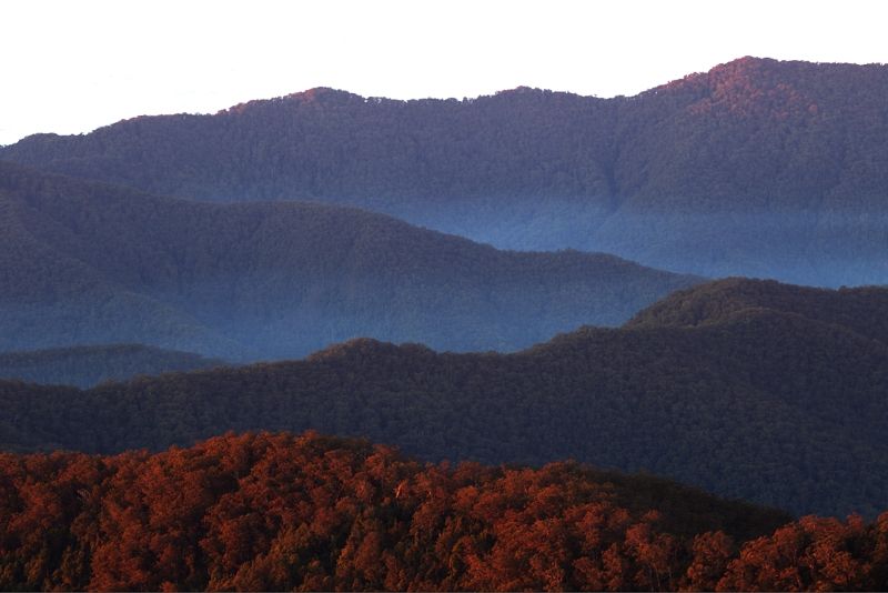
... but the Wattle is already blooming in the Peppermints and Red Stringybarks. Does that mean Winter has turned already? ... it would be nice to think so!

Image


Warren.

PS, If you're interested in looking at my pannier pig, there are a few shots on my Photobucket site ... http://s225.photobucket.com/user/WildWa ... ort=3&o=36" onclick="window.open(this.href);return false;

Re: Bicentennial National Trail

Posted: Thu Jul 04, 2013 10:15 am
by silentbutdeadly
Warren...you are seriously testing my 'passion' for my job and my day to day commitment to my family....

Re: Bicentennial National Trail

Posted: Fri Jul 05, 2013 9:27 pm
by petie
silentbutdeadly wrote:Warren...you are seriously testing my 'passion' for my job and my day to day commitment to my family....
QFT

Re: Bicentennial National Trail

Posted: Wed Jul 10, 2013 11:43 am
by DaSchmooze
Absolutely beautiful.

Re: Bicentennial National Trail

Posted: Tue Jul 15, 2014 8:45 pm
by VinceMD
amazing! Thanks for sharing

Re: Bicentennial National Trail

Posted: Mon Sep 22, 2014 3:12 pm
by Ross
So i wonder what ever became of Mediator? Did he/she ever go on their proposed journey with no maps and only one spare tyre?!

Re: Bicentennial National Trail

Posted: Mon Sep 22, 2014 4:34 pm
by RonK
Was heading for Alice Springs last post I can remember.

Re: Bicentennial National Trail

Posted: Sat Jun 20, 2015 7:08 am
by VinceMD
Long time.

After months of planning and preparation, I'm finally riding the BNT. It's been a hell of a ride, more like an adventure.
The volunteers are doing an amazing job considering the 5,000km+ to cover. We wish the government was helping out. As a rider I help out too by noting the mistakes in the guidebooks and sending feedback.

If you are interested you can read all about my adventures here: http://vincentonwheels.com .

Any question about the BNT, pleask ask. Facebook, or from the website or this forum

Re: Bicentennial National Trail

Posted: Thu Sep 03, 2015 11:31 pm
by WarrenH
During August I added a few more sections of the BNT's Main Trail, to my BNT knowledge.

Please enjoy a few shots from this Winter's very smokey atmosphere; from Moonan Brook to Stewarts Brook State Forest, on the Western edge of the Barrington Tops State Conservation Area. At Gologlie Creek Clearing looking West ... and part of the climb to Stewarts Brook.

Image

Image


Karamea to Hungry Hill above the Barnard River on the NE edge of the Barrington Tops State Forest ... on Giro Road aka Walcha Road. Giro Road was a real treat and is one of the great roads of NSW. But, from the gate at Hungry Hill, Hungry Hill deserves it's name. It is a steep, stony, nasty piece of work if ever there was one ... and then the track comes out onto that slither to Hell called Thunderbolts Way, 12 klicks South of Nowendoc. Despite being tarmac and a main regional road, the surface of Thunderbolts Way is a total disgrace, even for a rural road. Thunderbolts Way makes a mockery of the cynical phrase, good enough for rural. Go and have a look. You'll not ever question, if a road to Hell actually exists, not ever again.

Image

Image


From Georges Creek via George Creek Fire Trail up to the Cunnawarra Trail and the Styx River Travelling Stock Reserve, in New England. Georges Creek Fire Trail told me that I should have done this hike ... decades ago. It was just magic, despite having to cross a very cold creek, called Georges Creek, several times.

Image

Image

Image

Image

Image

Image

Cloudy at times.

Image


Warren.

Re: Bicentennial National Trail

Posted: Mon Sep 07, 2015 10:38 am
by silentbutdeadly
silentbutdeadly wrote:Warren...you are seriously testing my 'passion' for my job and my day to day commitment to my family....
This is still holding true...

Re: Bicentennial National Trail

Posted: Mon Sep 07, 2015 11:31 am
by bigfriendlyvegan
silentbutdeadly wrote:
silentbutdeadly wrote:Warren...you are seriously testing my 'passion' for my job and my day to day commitment to my family....
This is still holding true...
Someone told me about the BNT a couple of months ago. I googled it and found this thread. Since then I've been investigating camping equipment, working out training, and generally gearing up mentally to do this. It's on the list. Posts like Warren's are painful to look at as I'm sitting here looking at a bunch of poorly written regulations and preparing to have an argument with some bozo that I'm ultimately going to win. I now hate my English teacher from high school for having me memorise Clancy of the Overflow, because the stanzas below are on my mind every day.
I am sitting in my dingy little office, where a stingy
Ray of sunlight struggles feebly down between the houses tall,
And the foetid air and gritty of the dusty, dirty city
Through the open window floating, spreads its foulness over all

And in place of lowing cattle, I can hear the fiendish rattle
Of the tramways and the 'buses making hurry down the street,
And the language uninviting of the gutter children fighting,
Comes fitfully and faintly through the ceaseless tramp of feet.

And the hurrying people daunt me, and their pallid faces haunt me
As they shoulder one another in their rush and nervous haste,
With their eager eyes and greedy, and their stunted forms and weedy,
For townsfolk have no time to grow, they have no time to waste.

Re: Bicentennial National Trail

Posted: Wed Sep 16, 2015 11:41 am
by WarrenH
silentbutdeadly wrote:This is still holding true...
silentbutdeadly, well I'm truly sorry about that Sir. Let's see if these shots change anything, this time, OK?

At the top of the Cunnawarra Trail, in New England.

Image

Image


Lifting fog near Mount Esk, SE Qld. The section between Esk and Toogoolawah has been my most Northern sortie on the BNT, so-far.

Image


When you get out onto quite back roads like Walcha Road, NE of Barrington Tops State Forest, in NSW ... you're not too far from interested company. Cows like cyclists. And, if there are any consummate Pirelliologists looking at the next two shots ... Jedis, they are Serfas Drifters, 26" X 1.5". Now go home and rethink your life.

Image


Fan boys giving the Drifters their sign of approval.

Image


On a clear day you can see for ever ... but let's not break into song, OK. Patoneys Crown in the Gardens of Stone National Park, NSW. This shot was taken on the BNT alternate cycle route ... for those who may have already climbed Baal Bone Gap. It is a once in a life time thing, portaging to Baal Bone Gap ... no doubt seconded by those riders who have descended Baal Bone and lived.

Image


Early evening, approaching Basket Swamp, SE of the Boonoo Boonoo River, NSW. This shot reminds me how badly bitten I was by Sand Flies, when camped beside the Boonoo Boonoo River. I would have chewed my own legs off, just for any relief, if I hadn't had AERIUS in my medical kit.

Image


bigfriendlyvegan, G'day. Welcome to the BNT.

You will need serious levels of real protein, to take on the BNT ... and I hope you remain friendly?

Bicentennial National Trail

Posted: Wed Sep 16, 2015 12:39 pm
by RonK
WarrenH wrote:Cows giving the Drifters their signs of approval.

Image

You will need serious levels of real protein, to take on the BNT ...
Plenty of it right there Wassa. :)

Re: Bicentennial National Trail

Posted: Thu Sep 17, 2015 10:45 am
by silentbutdeadly
WarrenH wrote:
silentbutdeadly wrote:This is still holding true...
silentbutdeadly, well I'm truly sorry about that Sir. Let's see if these shots change anything, this time, OK?
No. Cheeky sod.

Oh and I can attest your thoughts re: Baal Bone Gap.

If you ever get back that way...I can recommend turning west on a side trip towards Ben Bullen & Capertee (at the top of Baal Bone) and then running down the Turon River and into the depths of Turon Gates, Palmers Oakey and Sofala...though some misty recollection suggests you've already done so in the past.

Re: Bicentennial National Trail

Posted: Wed Sep 23, 2015 10:48 am
by WarrenH
silentbutdeadly wrote:... and then running down the Turon River and into the depths of Turon Gates, Palmers Oakey and Sofala...though some misty recollection suggests you've already done so in the past.
Yes.

There was a fine cycling blog, dedicated to the Western Slopes and the Western Blue Mountains. I think that it was called, 'The Therapy of Pain' or something very similar. Sadly, the blog disappeared earlier this year. The bloke who had the blog, called this area Mordor. I think that the NSW Geological Names Board should rename the Upper Turon Region, Mordor! It is the perfect name for it.

silentbutdeadly wrote: No. Cheeky sod.
I feel mortally wounded after reading that. Silent' I haven't shown you shots of the BNT where I live, yet. Sorry, you'll just have to suffer. I spend a lot of time on the BNT near my home in the NW of the ACT, taking shots.

Two iconic buildings ...from the BNT's Main Trail at Dairy Farmers Hill and at Narabundah Hill. The BNT's Main Trail skirts the Western fringes of Canberra. Most cyclists short cut Canberra on the cycle paths ... and miss out on a lot of good riding.

Image

Image


The views are excellent.

Image

Image

With Roo Grass up to the bar ends.

Image


The BNT gets close to the Murrumbidgee River at time and crosses it in several places.

Image

Image

Image

Image

I hope that this helps.


Warren.

Re: Bicentennial National Trail

Posted: Fri Oct 02, 2015 9:43 pm
by silentbutdeadly
No. It doesn't help. You remain a cheeky sod. Long may you do so...