mitzikatzi wrote:I also found reference to being able to camp for 24hours on Stock Routes.
The 24 hours is historically the time that prevents the location, from being over-grazed. This time has not changed from the 1800s, the stock had to move on each day, by law. As a consequence most TSRs remain the original vegetation of Oz, the vegetation prior to European colonization. They are ribbons of genetic inheritance and valuable wildlife corridors.
I'm a huge fan of camping on the Travelling Stock Routes and in the Travelling Stock Reserves of NSW because if we don't use them in NSW, we could loose them. They are also (generally) pristine places, that have been used by drovers and shepherds since the mid 1830s. The TSRs in NSW and Qld along the Great Divide form the backbone of the Bicentennial National Trail.
The majority of my campsites are on TSRs. I can only talk or write about the ACT and NSW TSRs. I've not enjoyed the TSRs in the other states, except for knowing that TSRs no longer exist in Victoria. Victoria has moved to roadside grazing (permits). In Qld, there are 73,000 kilometres of extant TSRs, Qld has it together, and an amazing heritage to have preserved. In Qld the TSRs are called the Travelling Stock Route Network.
In NSW there are now only 1,600,000 ha of TSRs, after short sighted Governments sold many off. Most of the TSRs east of the Divide are now TSReserves but they are the historic campsites of the TSRoutes. Basically it is only along the Divide and West of the Divide that the big TSRoutes remain unbroken. From the Victorian Border we can still remain on a TSR right up to the Cape.
In NSW there are still 3,500 TSReserves. It is only in the Northern Rivers LHPA Region of NSW, where there are not many reserves remaining and where cyclists are charged a fee to camp. The TSR campsites are between 16 to 25 kilometres apart generally. That was the distance depending on the terrain, that stock could be walked in a day without over-stressing the animals and to access water.
Recreationally, we do not need to have liability insurance or submit permits to access a TSR. All we need to do is contact an LHPA Regional Ranger (from the Livestock Health and Protection Agency) to be granted access ... 48 hrs notice is best, but 24 hrs in advance is usually OK. If you are linking the TSRs together, tell the Ranger several TSRs at once, with your estimated times of arrival. In NSW, the directory and atlas
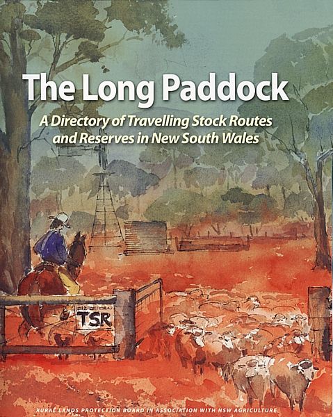
The Long Paddock details everything, including the availability and access to water (either from mills, pumps, bores, tanks, dams, creeks or rivers and even from springs, etc) on the TSRs. I purchased a copy of
The Long Paddock from the Goulburn LHPA Office, for $35 and $10 postage. The LHPA site ...
http://www.lhpa.org.au/contact" onclick="window.open(this.href);return false;
The first TSR in Oz was gazetted during the drought of 1835, after Aboriginal stockmen drove cattle from Lake George in the Southern Tablelands to Berridale in the Alps. The Bradfield Highway across the Sydney Harbour Bridge has not been decommissioned, that's the craziest and generally unknown TSR in OZ. One day it might be needed again. At Williamsdale Cricket Ground and on the Tharwa Common, and beside Mount Stromlo Forest Park (next to the Uriarra Rd carpark), are a few of the TSRs, here in the ACT.
The closest extant Travelling Stock Route to the ACT, is the Monteagle Travelling Stock Route. It starts at Coffee's Bridge, North of Boorawa, and it can be linked to other extant TSRoutes and remain unbroken, all the way to the Gulf.
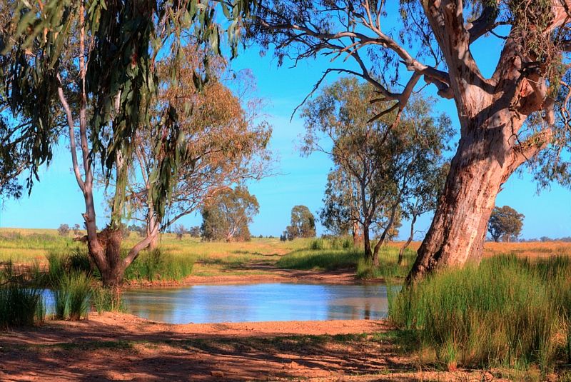
A crossing on the Tootool TSRoute in the Riverena.
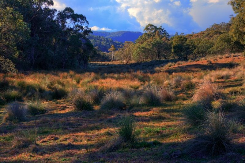
Waiborough TSReserve in the Southern Blue Mountains.
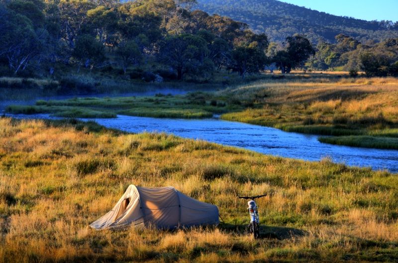
Yaouk TSReserve on the Murrumbidgee River below the Yaouk Bill Range, on the
Frost Plains of the North, the Australian Alps.
The signs should read, Reserved for Travelling Stock and Touring Cyclists ...
https://www.crazyguyonabike.com/doc/pag ... 66476&v=Px" onclick="window.open(this.href);return false;
The TSRoutes and TSReserves on and within 10 kilometres of the Bicentennial National Trail, are detailed in the BNT guide books.
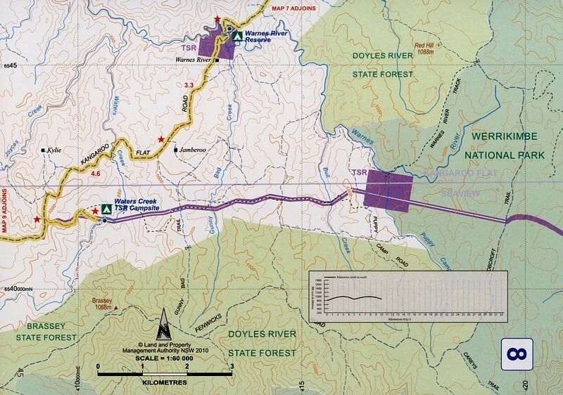
A corner of one of the 60 maps from
The Long Paddock. The stars are the locations of Travelling Stock Reserves.
The NSW State Forests maps show the TSRoutes and TSReserves in yellow.
Warren.
"But on steep descending...Larson TT have bad effect on the mind of a rider" - MadRider from Suji, Korea 2001.
"Paved roads ... another fine example of wasteful government spending." - a bumper sticker.