
Hello,
I'm a Canadian interested in cycling the East Coast of Australia. I've never been to your country before and I'm curious if anyone can provide me with some ideas about which route/roads/paths might be the best choice for my trip.
I'm hoping to go from Melbourne all the way up.
Any advice is appreciated. Thank you for your time.
Jon
Best Route - South to North
-
WarrenH

- Posts: 664
- Joined: Fri May 28, 2010 3:58 am
Re: Best Route - South to North
G'day. When are you thinking of travelling?
This is a country of climate extremes, absolutely, even on the milder coastal routes, when riding North, the wind can be against you for days ... and can I suggest (?) that you familiarise yourself with the BOM's weather site, to improve your comfort, against the wind and heat and the other extremes of weather.
When you wrote the East Coast ... is it the ride, the country or staying on the coast that interests you, mostly? Because if you mix-and-match, the best of the Eastern State routes, over the Great Escarpment and Coastal Ranges, alternating with the pick of the coastal routes ... you'll not forget your trip to Australia.
For example from Melbourne, perhaps head across to the Gippsland Lakes (coastal) visit the 90 Mile Beach, maybe stay at Locksport or Paynesville. Ride out along the giant silt getties and camp and take the ferry to Raymond Island to check out the Koalas and check out Cape Conran and Victoria's Wilderness Coast. Then perhaps North over the Aussie Alps, via Buchan, across the Gelantipy Plateau and Seldom Seen (inland) along the Snowy River to Jindabyne, then back down to the coast (through some obscure places along the Snowy River Way and Monaro Highway to the Snowy Mountains Highway), then ride a bit of the coastal tracks. At Moruya, head up the Deua River Valley, to Majors Creek (inland) and after Braidwood, head across the Budawang Escarpment to Nowra (again on the Coast), then ride sections of the Great South Coast Track, and perhaps ride through Royal National Park, or head back over the Great Escarpment towards Mittagong and the Wollindilly River Valley, through Wombeyan Caves Reserve to Kananga-Boyd National Park (at Kanangra Walls it is good camping and stunning views) and then to Jenolan Caves, or head further North to the Wolgan River Valley and maybe head back to Sydney, through Lithgow and the Eastern Blue Mountains (or catch a train back to Sydney, to avoid the traffic).... and on and on and on.
Anyway, this is a snapshot of a possible route from Melbourne to Sydney. There are places like Hill End and Sofala North of Bathurst that sharpen the senses, finely. The Hill End Bridal Track and Upper Turon Road are something else. They are extraordinary place to visit.
Don't miss out on the best riding places, by only sticking to the coast. There isn't too much traffic on this route, above (apart from Lithgow to Sydney). The best of the New South Wales South Coast, like Nadgi, Ben Boyd, Murramarang, Mimosa Rocks, Tuross Lakes and Mystery Bay (et al) are off the main roads. They're a tad out of the way but well worth slowing down for ... like everything else that I've suggested.
Warren.
Last edited by WarrenH on Sat Feb 01, 2014 12:41 am, edited 6 times in total.
"But on steep descending...Larson TT have bad effect on the mind of a rider" - MadRider from Suji, Korea 2001.
"Paved roads ... another fine example of wasteful government spending." - a bumper sticker.
"Paved roads ... another fine example of wasteful government spending." - a bumper sticker.
-
RonK

- Posts: 11508
- Joined: Mon Aug 24, 2009 2:08 pm
- Location: If you need to know, ask me
- Contact:
Re: Best Route - South to North
Hi Jon - PM your email address and I'll share some east coast route information.
Cycle touring blog and tour journals: whispering wheels...
-
il padrone

- Posts: 22931
- Joined: Mon Apr 07, 2008 11:57 pm
- Location: Heading for home.
Re: Best Route - South to North
I took this route from Sydney, north to Qld and finishing in Murwillumbah. Almost all on secondary roads and some forest roads; I rode barely 30kms on the Pacific Hwy, and that was the most unpleasant 30kms of the whole tour. This was ridden in August. Winds were mostly east or south-east. In summer you are more likely to get humid weather with north-easters.
Ideally if I was to ride from Melbourne to Brisbane I would be planning to ride out of Melbourne in March (if you want to do some swimmng on Victorian beaches) or even April or May.
Ideally if I was to ride from Melbourne to Brisbane I would be planning to ride out of Melbourne in March (if you want to do some swimmng on Victorian beaches) or even April or May.
Mandatory helmet law?
"An unjustified and unethical imposition on a healthy activity."
"An unjustified and unethical imposition on a healthy activity."
-
Warin

- Posts: 647
- Joined: Sat Sep 01, 2012 5:13 pm
Re: Best Route - South to North
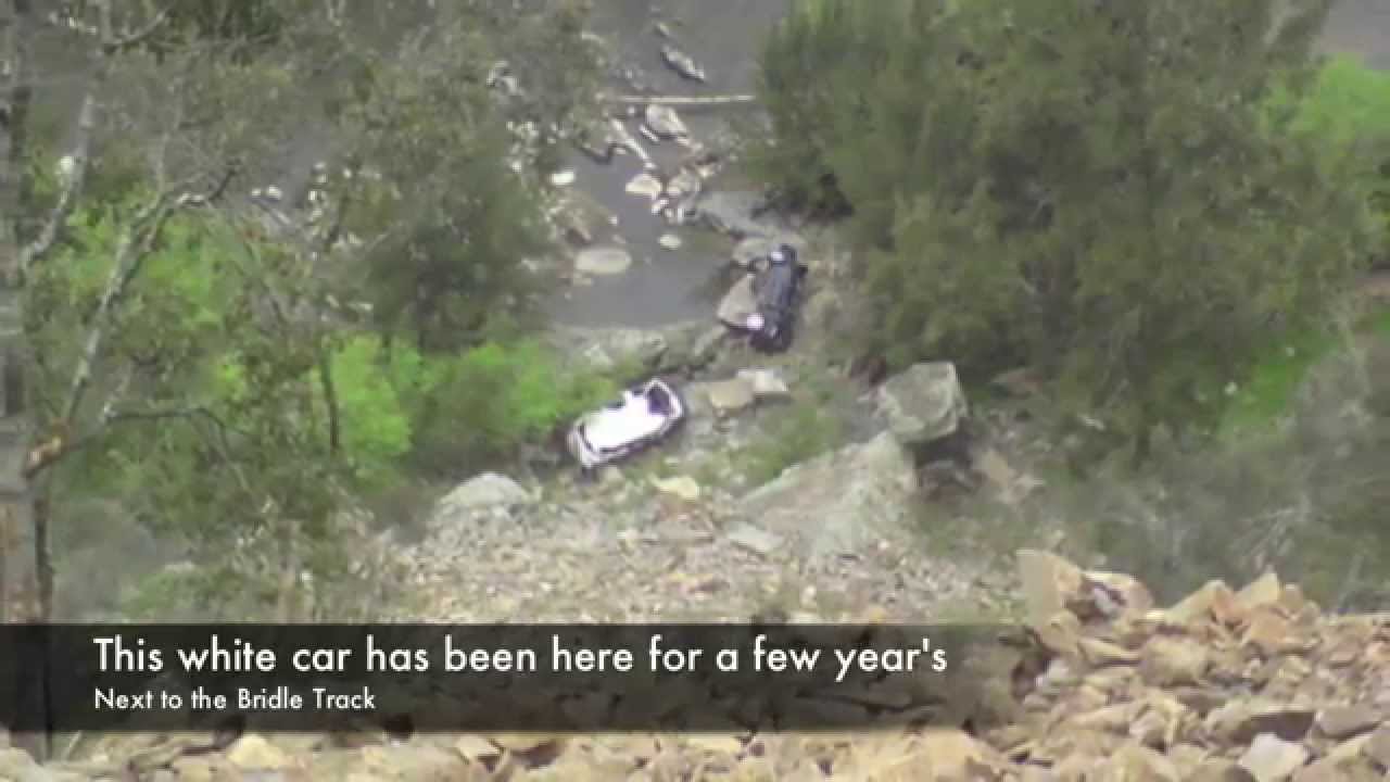
Last I heard the bridal track had two rock falls ... motorcycles were just getting past. But the local council may close it, meaning it may become 'closed' and back to private ownership.WarrenH wrote: There are places like Hill End and Sofala North of Bathurst that sharpen the senses, finely. The Hill End Bridal Track and Upper Turon Road are something else. They are extraordinary place to visit.
http://www.advrider.com/forums/showthread.php?t=609140" onclick="window.open(this.href);return false;
-
WarrenH
- Posts: 664
- Joined: Fri May 28, 2010 3:58 am
Re: Best Route - South to North
JobB, G'day again. I also should have mentioned, exiting the Wolgan Valley there are two excellent routes towards Lithgow by the Old Coach Road or at the head of the valley, taking the Black Fellows Hand Fire Trail. The Old Coach Road is more difficult than Black Fellows Hand. The Historic Wolgan Valley is cool and outside of the holiday periods and long weekends ... you could have the place to yourself.
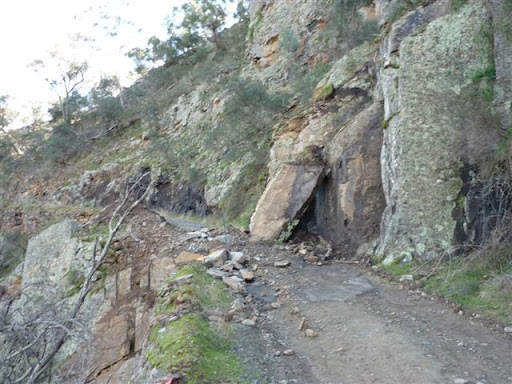
The Bridal Trail, for those who might not know, was the route to take supplies to the Turon Goldfields. At Monahans Bluff, the spectacular cliff top pass, high above above the Macquarie River, the road is blocked to vehicles by a large vertical slab of rock. The pass is now about 2m wide here, perfect for off-road cycling and backpacking. The cliff face retaining wall over the edge, is just stacked up stones, from the 1800s and no longer considered adequate engineering, to allow the road to be repaired for vehicle access ... but it is still a very spectacular route.
If you want to see images from a hot and smokey SE Oz? ... http://s225.photobucket.com/user/WildWa ... t=3&page=1" onclick="window.open(this.href);return false;
Cheers.
Warren.
Yes, about the rock falls. On both entrances to the Bridal Trail, there are signs that say road closed. Cyclists are still taking the route though. The council has an advised route change for the local property owner's vehicles, by access along Root Hog Fire Trail.Warin wrote:Last I heard the bridal track had two rock falls ... motorcycles were just getting past. But the local council may close it, meaning it may become 'closed' and back to private ownership.WarrenH wrote: There are places like Hill End and Sofala North of Bathurst that sharpen the senses, finely. The Hill End Bridal Track and Upper Turon Road are something else. They are extraordinary place to visit.
http://www.advrider.com/forums/showthread.php?t=609140" onclick="window.open(this.href);return false;
The Bridal Trail, for those who might not know, was the route to take supplies to the Turon Goldfields. At Monahans Bluff, the spectacular cliff top pass, high above above the Macquarie River, the road is blocked to vehicles by a large vertical slab of rock. The pass is now about 2m wide here, perfect for off-road cycling and backpacking. The cliff face retaining wall over the edge, is just stacked up stones, from the 1800s and no longer considered adequate engineering, to allow the road to be repaired for vehicle access ... but it is still a very spectacular route.
If you want to see images from a hot and smokey SE Oz? ... http://s225.photobucket.com/user/WildWa ... t=3&page=1" onclick="window.open(this.href);return false;
Cheers.
Warren.
Last edited by WarrenH on Sun Feb 02, 2014 10:43 am, edited 4 times in total.
"But on steep descending...Larson TT have bad effect on the mind of a rider" - MadRider from Suji, Korea 2001.
"Paved roads ... another fine example of wasteful government spending." - a bumper sticker.
"Paved roads ... another fine example of wasteful government spending." - a bumper sticker.
-
il padrone
- Posts: 22931
- Joined: Mon Apr 07, 2008 11:57 pm
- Location: Heading for home.
Re: Best Route - South to North
Quick search on Google gave me some photos - yep that might stop the 4WD boys 
Mandatory helmet law?
"An unjustified and unethical imposition on a healthy activity."
"An unjustified and unethical imposition on a healthy activity."
-
ldrcycles

- Posts: 9594
- Joined: Thu Oct 28, 2010 3:19 pm
- Location: Kin Kin, Queensland
Re: Best Route - South to North
I'll pop my 2 bob in, once you get to Brisbane there aren't a lot of coastal options. From Brisbane to Caloundra the easternmost road you can take is Steve Irwin Way, which has lots of traffic and several stretches with no shoulder at all, it's no fun at all. But to avoid that the only other way (besides going a long way inlandis to take the D'Aguilar Highway out past Woodford, go north through Maleny to Montville and then east to Maroochydore. From there you can follow the coast road (David Low Way) up to Noosa, which is a beautiful stretch. From there to Gympie you have a few options, all of which are hilly.
Alternatively, you could turn west at Maleny and go through Conondale and Kenilworth down through the Mary Valley to Gympie, there is some beautiful scenery out there and usually not much traffic.
North of Gympie I have no idea, there aren't a lot of roads up there that I'm aware of besides Highway 1, and even if cyclists are allowed on that stretch (they might be) I would not want to ride on it anyway.
I'm approaching this from the point of view of a road rider though, if you are going to tour off road then the Bicentennial National Trail would probably be the go for most of Queensland.
-
BlackDogBicycling
- Posts: 1
- Joined: Wed Feb 05, 2014 6:24 pm
Re: Best Route - South to North
Hi WarrenH,WarrenH wrote:G'day. When are you thinking of travelling?
For example from Melbourne, perhaps head across to the Gippsland Lakes (coastal) visit the 90 Mile Beach, maybe stay at Locksport or Paynesville. Ride out along the giant silt getties and camp and take the ferry to Raymond Island to check out the Koalas and check out Cape Conran and Victoria's Wilderness Coast. Then perhaps North over the Aussie Alps, via Buchan, across the Gelantipy Plateau and Seldom Seen (inland) along the Snowy River to Jindabyne, then back down to the coast (through some obscure places along the Snowy River Way and Monaro Highway to the Snowy Mountains Highway), then ride a bit of the coastal tracks. At Moruya, head up the Deua River Valley, to Majors Creek (inland) and after Braidwood, head across the Budawang Escarpment to Nowra (again on the Coast), then ride sections of the Great South Coast Track, and perhaps ride through Royal National Park, or head back over the Great Escarpment towards Mittagong and the Wollindilly River Valley, through Wombeyan Caves Reserve to Kananga-Boyd National Park (at Kanangra Walls it is good camping and stunning views) and then to Jenolan Caves, or head further North to the Wolgan River Valley and maybe head back to Sydney, through Lithgow and the Eastern Blue Mountains (or catch a train back to Sydney, to avoid the traffic).... and on and on and on.
Anyway, this is a snapshot of a possible route from Melbourne to Sydney. There are places like Hill End and Sofala North of Bathurst that sharpen the senses, finely. The Hill End Bridal Track and Upper Turon Road are something else. They are extraordinary places.
Warren.
I'm about to set off from Melbourne for Sydney (small matter of Tas first) how long do you think is realistic?
-
il padrone
- Posts: 22931
- Joined: Mon Apr 07, 2008 11:57 pm
- Location: Heading for home.
Re: Best Route - South to North
If you're heading of on tour in the next few weeks, yes, spend 2-3 weeks at the minimum, in Tasmania. Then head off north from Melbourne.
Time-wise I'd be allowing at least 4 weeks, perhaps 6 if you want to explore into the mountains and back-roads. 16 years ago I spent 3 weeks riding Sydney to the Qld border. Loved it too. Many years ago a couple of friends of mine rode Melb-Brissie in two weeks (with one rest day). I didn't join them - in January I went to Tassie and I think had a much better time. They just rode the Pacific Hwy up north, and saw trucks & buses And summer rains
Time-wise I'd be allowing at least 4 weeks, perhaps 6 if you want to explore into the mountains and back-roads. 16 years ago I spent 3 weeks riding Sydney to the Qld border. Loved it too. Many years ago a couple of friends of mine rode Melb-Brissie in two weeks (with one rest day). I didn't join them - in January I went to Tassie and I think had a much better time. They just rode the Pacific Hwy up north, and saw trucks & buses
Mandatory helmet law?
"An unjustified and unethical imposition on a healthy activity."
"An unjustified and unethical imposition on a healthy activity."
-
WarrenH
- Posts: 664
- Joined: Fri May 28, 2010 3:58 am
Re: Best Route - South to North
Black Dog, G'day. Sorry to run away, during your post. I was down the hill on the NSW South Coast during this week past, checking out a couple of routes that link to the Great South Coast Track.
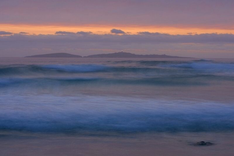
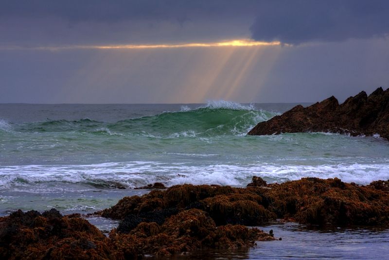
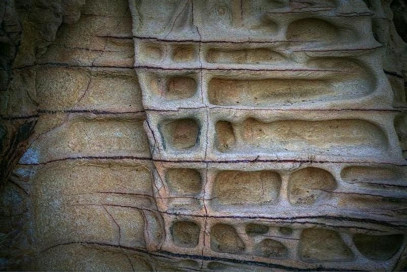
My Son Geoffrey and I, spent time exploring more of the Great South Coast Track. Checking out the cycle paths and formations on the advised cycle routes through Eurobodalla ... http://www.eurobodalla.com.au/cycling" onclick="window.open(this.href);return false;
The number of cyclists that we saw touring between Moruya and Central Tilba, was totally inspiring. Geoff and I didn't get far, but we never do. The cyclists that we saw on the cycle trails appeared to be most comfortable, and in cruise mode. Although, we did chat to a couple of riders that weren't enjoying beating into erratic head winds. A couple of visitors, a Korean bloke and a German bloke, were struggling to make ground, sticking to the Pacific Highway route. It was sad, that's they thought that riding up the South Coast on the Pacific, was what it was about. There are many energy sucking undulations on the Pacific down on the NSW South Coast. The best of the shoulders (the wider ones on the Pacific) are only on the up-slopes ... but do allow more wobble room ... but on the down slopes, there are basically none, certainly none wider than the weed encroached and broken shoulders at about 30-40cm. The new highway alignment adjacent to the Tilbas, is about the best bit, steep rollers.
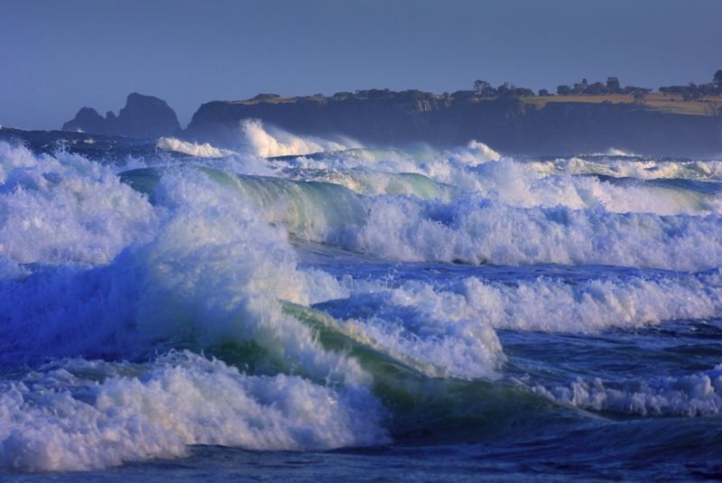
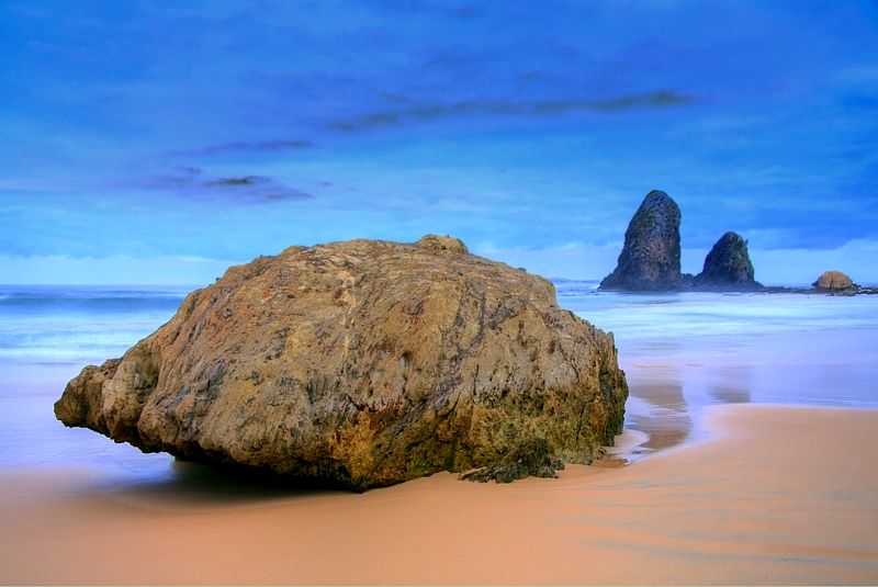
The wind rose was erratic this past week but today was as-hot-as and smokey or misty most days. The seas were wild early in the week, most spectacular.
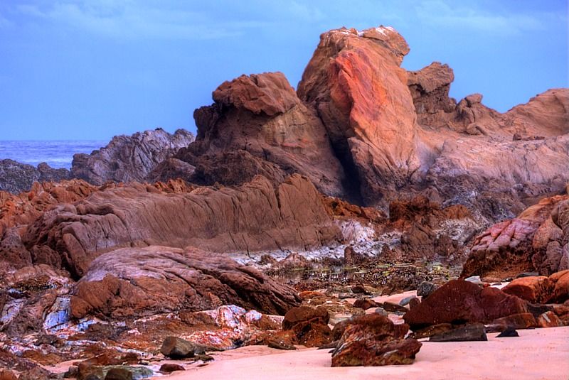
A couple of shots from the last few days in Eurobodalla.
Duesburys Beach.
Narooma Beach.
Smoke and sea mist, before sunrise at Glass House Rocks.
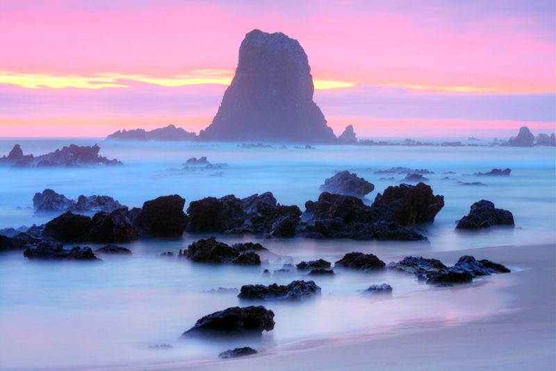
Warren.
My Son Geoffrey and I, spent time exploring more of the Great South Coast Track. Checking out the cycle paths and formations on the advised cycle routes through Eurobodalla ... http://www.eurobodalla.com.au/cycling" onclick="window.open(this.href);return false;
The number of cyclists that we saw touring between Moruya and Central Tilba, was totally inspiring. Geoff and I didn't get far, but we never do. The cyclists that we saw on the cycle trails appeared to be most comfortable, and in cruise mode. Although, we did chat to a couple of riders that weren't enjoying beating into erratic head winds. A couple of visitors, a Korean bloke and a German bloke, were struggling to make ground, sticking to the Pacific Highway route. It was sad, that's they thought that riding up the South Coast on the Pacific, was what it was about. There are many energy sucking undulations on the Pacific down on the NSW South Coast. The best of the shoulders (the wider ones on the Pacific) are only on the up-slopes ... but do allow more wobble room ... but on the down slopes, there are basically none, certainly none wider than the weed encroached and broken shoulders at about 30-40cm. The new highway alignment adjacent to the Tilbas, is about the best bit, steep rollers.
The wind rose was erratic this past week but today was as-hot-as and smokey or misty most days. The seas were wild early in the week, most spectacular.
A couple of shots from the last few days in Eurobodalla.
Duesburys Beach.
Narooma Beach.
Smoke and sea mist, before sunrise at Glass House Rocks.
Warren.
Last edited by WarrenH on Sat Feb 08, 2014 5:32 am, edited 9 times in total.
"But on steep descending...Larson TT have bad effect on the mind of a rider" - MadRider from Suji, Korea 2001.
"Paved roads ... another fine example of wasteful government spending." - a bumper sticker.
"Paved roads ... another fine example of wasteful government spending." - a bumper sticker.
-
WarrenH
- Posts: 664
- Joined: Fri May 28, 2010 3:58 am
Re: Best Route - South to North
Sorry, dupe post.
Warren.
Warren.
"But on steep descending...Larson TT have bad effect on the mind of a rider" - MadRider from Suji, Korea 2001.
"Paved roads ... another fine example of wasteful government spending." - a bumper sticker.
"Paved roads ... another fine example of wasteful government spending." - a bumper sticker.
-
rifraf

- Posts: 3851
- Joined: Fri Apr 15, 2011 5:55 pm
- Location: Two Rocks, WA
Re: Best Route - South to North
Fantastic pics as ever Wazza.
Thanks for sharing
Thanks for sharing
Surly Ogre, Extrawheel trailer.
-
yugyug

- Posts: 1826
- Joined: Thu Sep 20, 2012 10:27 am
- Location: Sydney
Re: Best Route - South to North
Fantastic pics!
you carried a tripod?
you carried a tripod?
-
il padrone
- Posts: 22931
- Joined: Mon Apr 07, 2008 11:57 pm
- Location: Heading for home.
Re: Best Route - South to North
If you should feel that you need one - Zipshotyugyug wrote:you carried a tripod?
Yes, awesome photos again Warren. You put many of us to shame with the outstanding quality of light and scenes in those photos
Mandatory helmet law?
"An unjustified and unethical imposition on a healthy activity."
"An unjustified and unethical imposition on a healthy activity."
-
WarrenH
- Posts: 664
- Joined: Fri May 28, 2010 3:58 am
Re: Best Route - South to North
Rif' and Yug', G'day. I'm pleased that you like the shots. Thank you. Rif', a belated Happy New Year to you Mate.
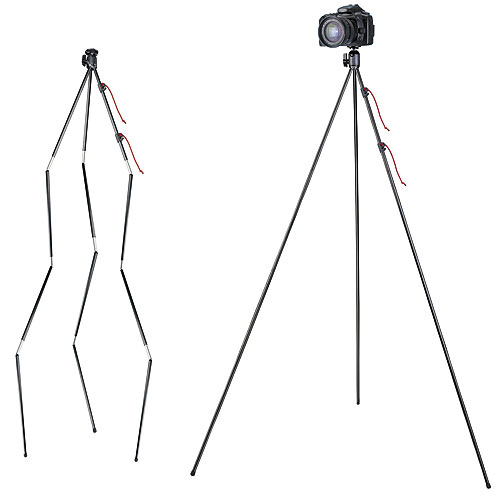
Yug', the tripod is the first thing that I pack. Just like how we choose bikes for the conditions, I take a tripod for the conditions. I don't always take it off the bike or off the trailer. I like to think that I can hold a camera steady, most days. I only use the tripod for the slower shutter speeds and time exposures or when I'm hunting for an extended depth of field or something special that warrants good quality.
This was a somewhat longish set of exposures (an HDR, a composite of a 40 second exposure, a 20 sec and a 10 sec @f16.0) ... Montague Island Light from Handkerchief Beach.
Some handheld images at Yabarra Headland, again all from this past week. They're all a tad soft. My camera handling skills can't match even my cheapest tripod. I only take Canon kit lenses touring.
Tripods for all touring occasions. L-R a Serui N1204 8 ply carbon with K20 ball head (1.453kg, perfect for the windy coast with quality movements and good max height, a top tripod, purchased from Mainline in North Sydney), an old Velbon CX something or other (1.487kg including the green gaffer tape). A faithful old hacker that I throw over fences, that can be raised above my eye level and thirdly the tripod that I take almost always touring nowadays, A Velbon CX 444 (1.223kg). The CX 444, is a bit flimsy, compared to the two other tripods and it is a bit short in its maximum height but it's quick to use, light to haul and cheap to loose.

Warren.
Yug', the tripod is the first thing that I pack. Just like how we choose bikes for the conditions, I take a tripod for the conditions. I don't always take it off the bike or off the trailer. I like to think that I can hold a camera steady, most days. I only use the tripod for the slower shutter speeds and time exposures or when I'm hunting for an extended depth of field or something special that warrants good quality.
This was a somewhat longish set of exposures (an HDR, a composite of a 40 second exposure, a 20 sec and a 10 sec @f16.0) ... Montague Island Light from Handkerchief Beach.
Some handheld images at Yabarra Headland, again all from this past week. They're all a tad soft. My camera handling skills can't match even my cheapest tripod. I only take Canon kit lenses touring.
Tripods for all touring occasions. L-R a Serui N1204 8 ply carbon with K20 ball head (1.453kg, perfect for the windy coast with quality movements and good max height, a top tripod, purchased from Mainline in North Sydney), an old Velbon CX something or other (1.487kg including the green gaffer tape). A faithful old hacker that I throw over fences, that can be raised above my eye level and thirdly the tripod that I take almost always touring nowadays, A Velbon CX 444 (1.223kg). The CX 444, is a bit flimsy, compared to the two other tripods and it is a bit short in its maximum height but it's quick to use, light to haul and cheap to loose.
Warren.
"But on steep descending...Larson TT have bad effect on the mind of a rider" - MadRider from Suji, Korea 2001.
"Paved roads ... another fine example of wasteful government spending." - a bumper sticker.
"Paved roads ... another fine example of wasteful government spending." - a bumper sticker.
-
RonK
- Posts: 11508
- Joined: Mon Aug 24, 2009 2:08 pm
- Location: If you need to know, ask me
- Contact:
Re: Best Route - South to North
It's not clear if you a considering going further north than the Gold Coast and Brisbane, but the Bruce Hwy is notoriously dangerous, particularly for cyclists, and difficult to avoid. It is possible to take an inland route, but this is through mostly agricultural and mining regions so you miss many of the coastal locations most visit Queensland to see. However I think I have route in Google Maps if you want to see it.
Also, since Australia straddles both tropical and temperate zones, the weather and direction of travel becomes an issue. The wet season in the north runs from December thru March, it's very hot and humid when it's not raining heavily, and there are likely to be cyclones. Flooding and road closures are common. And you cannot swim in the sea for the deadly box jellyfish and irukanji are active at this time. By contrast, in southern Australia it will be dry and very hot, and bushfires such as we are experiencing in Victoria right now are common.
Cold temps may not bother you but in winter frosty weather is not unusual in the south, and even in inland parts of Queensland.
The best advice would be to start in the north at the beginning of spring - that way you should get the best of the weather along the route.
As an alternative to riding north of Brisbane, you could start your tour in Adelaide and ride the coastal route including the Great Ocean Road to Melbourne then continue on the East Coast Explorer route. Another excellent inclusion would be to take the ferry across Bass Strait and do a lap of Tasmania. Finally, it is well worthwhile considering extending your visit to New Zealand. The South Island in particular has stunning scenery and quiet roads and is a great place to tour.
Cycle touring blog and tour journals: whispering wheels...
-
JonB
- Posts: 3
- Joined: Fri Jan 31, 2014 7:17 am
Re: Best Route - South to North
Thanks to everyone for the information posted here, it'll be great food for thought.
I'll be biking from the middle of April to the End of May. Not too long, but long enough to get a good feel for it. I'd love to make it longer, but I've some obligations back in Canada at the start of June.
At the moment, I am starting in the South (would love to go from Adelaide) around and up. I've read that the prevailing winds at that time of year should be with me.
I don't know if this is a message for this or if I should start another thread (perhaps look around a bit more) but I've a bivy sack with me. Should I get a tent instead? I'm only wondering about snakes along the route... if they would be attracted to my large warm bivy at night.
-
il padrone
- Posts: 22931
- Joined: Mon Apr 07, 2008 11:57 pm
- Location: Heading for home.
Re: Best Route - South to North
However, acknlowledging that, many cyclists tour around Australia and most of them will probably ride the Bruce Hwy for a good distance. I have not heard of a rash of cyclist deaths or injuries up there. It is not pleasant - main highways rarely are.RonK wrote:It's not clear if you a considering going further north than the Gold Coast and Brisbane, but the Bruce Hwy is notoriously dangerous, particularly for cyclists, and difficult to avoid.
Common in the inland parts but we have not had serious frosts for years now in Melbourne. Climate change and urban heat islands in action.RonK wrote:Cold temps may not bother you but in winter frosty weather is not unusual in the south, and even in inland parts of Queensland.
Curious - I would have advised to start form Melbourne or Sydney in the autumn and head north, for better weather and to avoid the cyclone season.RonK wrote:The best advice would be to start in the north at the beginning of spring - that way you should get the best of the weather along the route.
All very good advice.RonK wrote:As an alternative to riding north of Brisbane, you could start your tour in Adelaide and ride the coastal route including the Great Ocean Road to Melbourne then continue on the East Coast Explorer route. Another excellent inclusion would be to take the ferry across Bass Strait and do a lap of Tasmania. Finally, it is well worthwhile considering extending your visit to New Zealand. The South Island in particular has stunning scenery and quiet roads and is a great place to tour.
A bivvy bag should be fine if you can stand the cramped living space for so many weeks. I'd hate it. Snakes will generally not be active too much at night (cold-blooded, they need warmth from the sun to get active) and I've not ever heard of anyone finding one trying to get into their tent at night.
Mandatory helmet law?
"An unjustified and unethical imposition on a healthy activity."
"An unjustified and unethical imposition on a healthy activity."
-
ldrcycles
- Posts: 9594
- Joined: Thu Oct 28, 2010 3:19 pm
- Location: Kin Kin, Queensland
Re: Best Route - South to North
The Bruce Highway between Cooroy and Yandina is great for riding, lots of visibility with a huge well surfaced shoulder and not much traffic, far safer than any of the surrounding roads. But Main Roads banned cyclists from that stretch last year as "schoolchildren could use it"  . To the best of my knowledge, bicycles are banned on the Bruce highway from it's southernmost point at the Pine River bridge through to Gympie.
-
il padrone
- Posts: 22931
- Joined: Mon Apr 07, 2008 11:57 pm
- Location: Heading for home.
Re: Best Route - South to North
So there is a good alternative route that does not involve hundreds of extra kms ??
Otherwise it simply smacks of exclusion and transport discrimination.
[edit] Brisbane suburbs to Gympie !! That is 150kms of road closed off to cyclists. Yep, transport discrimination at its finest
Otherwise it simply smacks of exclusion and transport discrimination.
[edit] Brisbane suburbs to Gympie !! That is 150kms of road closed off to cyclists. Yep, transport discrimination at its finest
Mandatory helmet law?
"An unjustified and unethical imposition on a healthy activity."
"An unjustified and unethical imposition on a healthy activity."
-
ldrcycles
- Posts: 9594
- Joined: Thu Oct 28, 2010 3:19 pm
- Location: Kin Kin, Queensland
Re: Best Route - South to North
My thoughts exactly, hence why I will ride there if and when I feel the need to do so, I paid for the damn road after all!il padrone wrote:So there is a good alternative route that does not involve hundreds of extra kms ??
Otherwise it simply smacks of exclusion and transport discrimination.
[edit] Brisbane suburbs to Gympie !! That is 150kms of road closed off to cyclists. Yep, transport discrimination at its finest
-
bagelonabike
- Posts: 78
- Joined: Tue Jan 08, 2013 1:06 pm
- Contact:
Re: Best Route - South to North
Warren thanks for this post - some good info here.WarrenH wrote:G'day. When are you thinking of travelling?
This is a country of climate extremes, absolutely, even on the milder coastal routes, when riding North, the wind can be against you for days ... and can I suggest (?) that you familiarise yourself with the BOM's weather site, to improve your comfort, against the wind and heat and the other extremes of weather.
When you wrote the East Coast ... is it the ride, the country or staying on the coast that interests you, mostly? Because if you mix-and-match, the best of the Eastern State routes, over the Great Escarpment and Coastal Ranges, alternating with the pick of the coastal routes ... you'll not forget your trip to Australia.
For example from Melbourne, perhaps head across to the Gippsland Lakes (coastal) visit the 90 Mile Beach, maybe stay at Locksport or Paynesville. Ride out along the giant silt getties and camp and take the ferry to Raymond Island to check out the Koalas and check out Cape Conran and Victoria's Wilderness Coast. Then perhaps North over the Aussie Alps, via Buchan, across the Gelantipy Plateau and Seldom Seen (inland) along the Snowy River to Jindabyne, then back down to the coast (through some obscure places along the Snowy River Way and Monaro Highway to the Snowy Mountains Highway), then ride a bit of the coastal tracks. At Moruya, head up the Deua River Valley, to Majors Creek (inland) and after Braidwood, head across the Budawang Escarpment to Nowra (again on the Coast), then ride sections of the Great South Coast Track, and perhaps ride through Royal National Park, or head back over the Great Escarpment towards Mittagong and the Wollindilly River Valley, through Wombeyan Caves Reserve to Kananga-Boyd National Park (at Kanangra Walls it is good camping and stunning views) and then to Jenolan Caves, or head further North to the Wolgan River Valley and maybe head back to Sydney, through Lithgow and the Eastern Blue Mountains (or catch a train back to Sydney, to avoid the traffic).... and on and on and on.
Anyway, this is a snapshot of a possible route from Melbourne to Sydney. There are places like Hill End and Sofala North of Bathurst that sharpen the senses, finely. The Hill End Bridal Track and Upper Turon Road are something else. They are extraordinary place to visit.
Don't miss out on the best riding places, by only sticking to the coast. There isn't too much traffic on this route, above (apart from Lithgow to Sydney). The best of the New South Wales South Coast, like Nadgi, Ben Boyd, Murramarang, Mimosa Rocks, Tuross Lakes and Mystery Bay (et al) are off the main roads. They're a tad out of the way but well worth slowing down for ... like everything else that I've suggested.
Warren.
I'm doing the Melbourne - Sydney part of this trip myself in early April. Might see you on the road JonB!
-
il padrone
- Posts: 22931
- Joined: Mon Apr 07, 2008 11:57 pm
- Location: Heading for home.
Re: Best Route - South to North
On the way to the Ninety Mile Beach area (never an area I've found too thrilling for cycling sadly, way too flat and windy) don't forget you have the choice of riding either the beautiful and scenic Grand Ridge Road through the Strzelecki Ranges; or the peaceful South Gippsland Rail-trail through to Toora, and then into the coastal hills through the Hedley Range, Binginwarri, and Jacks River to Yarram.
Mandatory helmet law?
"An unjustified and unethical imposition on a healthy activity."
"An unjustified and unethical imposition on a healthy activity."
-
bagelonabike
- Posts: 78
- Joined: Tue Jan 08, 2013 1:06 pm
- Contact:
Re: Best Route - South to North
I was going to go from Venus Bay>Fish creek>Foster along the "C" roads. Is that do-able you think?il padrone wrote:or the peaceful South Gippsland Rail-trail through to Toora, and then into the coastal hills through the Hedley Range, Binginwarri, and Jacks River to Yarram.
Who is online
Users browsing this forum: No registered users