
If you could cycle tour anywhere in Australia, where would you go? I hope to do some Aussie tours as my holidays over the next few years, so I'm scheming about where I could go in holidays lasting 2-3 weeks. Got frequent flyer points saved up to reach start points. Prefer sealed roads, and mostly camping as accommodation.
I've cycle toured around Tasmania and I'd go there again, but mostly I like to go somewhere I've never been. I've driven along the Great Ocean Road twice - I'd cycle it but ... been there, done that. I've driven bloody everywhere actually, except for WA and far north Qld.
On the map, I was thinking the southwest of Western Australia looks like prime cycling territory. Around Margaret River and down to Albany. Maybe the mountain regions of Victoria and southern NSW? South Australian wine country?
Best place to tour in Australia?
-
Tale

- Posts: 629
- Joined: Sun Aug 03, 2008 9:42 pm
- Location: Sydney
Best place to tour in Australia?
Fuji Roubaix RC 2009 - Trek 520 1998 - Touring videos - Commute
-
JustinS007
- Posts: 244
- Joined: Mon Sep 22, 2008 8:09 pm
- Location: Wangaratta
Re: Best place to tour in Australia?
Probably Barossa Valley and up into the hills north of Adelaide. Never been there.Tale wrote:If you could cycle tour anywhere in Australia, where would you go?
That's where I live (Wangaratta) and there are some really good ride here. I always seem to be heading east (and occasionally North). Rarely South through Benalla or West to Shepparton (unless I dod a quick 50 over the Warby's and back).Maybe the mountain regions of Victoria
J.[/quote]
I'm a runner, but I sure love to ride!
-
Lonebiker

- Posts: 22
- Joined: Sun Oct 07, 2007 12:36 am
- Location: Denmark
- Contact:
-
il padrone

- Posts: 22931
- Joined: Mon Apr 07, 2008 11:57 pm
- Location: Heading for home.
Here's a route I took about 10 years ago. I spent 3 weeks doing it. 
http://www.bikely.com/maps/bike-path/Ma ... Palm-Beach
http://www.bikely.com/maps/bike-path/Pa ... -Macquarie
http://www.bikely.com/maps/bike-path/North-Coast-NSW-3
15 years earlier two mates of mine rode Melbourne to Brisbane in 2 weeks. Puts me to shame Not trying to set any records, I was out to sniff the flowers
  A woderful tour, only rode 30kms on the Pacific Hwy, lots of lovely quiet backroads and country towns.
Might be one of the places you've 'been there, done that' I guess.
http://www.bikely.com/maps/bike-path/Ma ... Palm-Beach
http://www.bikely.com/maps/bike-path/Pa ... -Macquarie
http://www.bikely.com/maps/bike-path/North-Coast-NSW-3
15 years earlier two mates of mine rode Melbourne to Brisbane in 2 weeks. Puts me to shame
Might be one of the places you've 'been there, done that' I guess.
Mandatory helmet law?
"An unjustified and unethical imposition on a healthy activity."
"An unjustified and unethical imposition on a healthy activity."
-
Crankitup

- Posts: 91
- Joined: Thu Aug 21, 2008 7:26 pm
- Contact:
Had a look at them all on Google Maps Street View. They look pretty good.il padrone wrote:Here's a route I took about 10 years ago. I spent 3 weeks doing it.
http://www.bikely.com/maps/bike-path/Ma ... Palm-Beach
http://www.bikely.com/maps/bike-path/Pa ... -Macquarie
http://www.bikely.com/maps/bike-path/North-Coast-NSW-3
15 years earlier two mates of mine rode Melbourne to Brisbane in 2 weeks. Puts me to shame
Might be one of the places you've 'been there, done that' I guess.
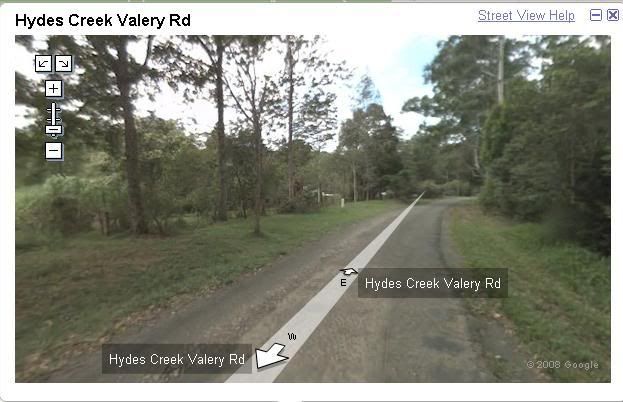
Here's a snapshot from the last one;
Looks like you wouldn't encounter much traffic either.
Neil C.
Bacchetta Corsa '05
Perth W.A.
Bacchetta Corsa '05
Perth W.A.
-
il padrone
- Posts: 22931
- Joined: Mon Apr 07, 2008 11:57 pm
- Location: Heading for home.
Yes, I remember that section of road well as a very peaceful forest road, a narrow sealed surface with gentle climbs to a ridge then a gradual descent towards the coast. Only downside was that 15kms later I had to ride 3-4kms along the Pacific Hwy to the Sawtell turn-off  Horrible traffic.
Macksville to Coffs Harbour via Bowraville and Bellingen was a great section of the trip (apart from that bit of highway).
Hey, how did you copy the street view image? I can't seem to do that, but would love to be able to.
Macksville to Coffs Harbour via Bowraville and Bellingen was a great section of the trip
Hey, how did you copy the street view image? I can't seem to do that, but would love to be able to.
Mandatory helmet law?
"An unjustified and unethical imposition on a healthy activity."
"An unjustified and unethical imposition on a healthy activity."

-
il padrone
- Posts: 22931
- Joined: Mon Apr 07, 2008 11:57 pm
- Location: Heading for home.
-
Crankitup
- Posts: 91
- Joined: Thu Aug 21, 2008 7:26 pm
- Contact:
Seems Caelum has answered before I had a chance to get back to you.il padrone wrote: Hey, how did you copy the street view image? I can't seem to do that, but would love to be able to.
I would just add that you will need to do some cropping.
Also Paint likes to save the file as a BMP by default. This will result in a fairly large file. Save as jpg instead. You won't notice the difference in quality & the file size will be much smaller.
Neil C.
Bacchetta Corsa '05
Perth W.A.
Bacchetta Corsa '05
Perth W.A.
-
timbo
- Moderator

- Posts: 1001
- Joined: Mon Dec 12, 2005 5:42 pm
- Location: sydney
I've done Albany to Margaret River area by car and can recommend it.
Bicycle Victoria are having one of their "Great Rides" there next year.
you can check out their route etc at http://www.bv.com.au/great-rides/30589
Bicycle Victoria are having one of their "Great Rides" there next year.
you can check out their route etc at http://www.bv.com.au/great-rides/30589
-
Tale
- Posts: 629
- Joined: Sun Aug 03, 2008 9:42 pm
- Location: Sydney
Thanks for the advice all. Excited about where I might go now.
Fuji Roubaix RC 2009 - Trek 520 1998 - Touring videos - Commute
-
Chris L
- Posts: 58
- Joined: Sat Oct 25, 2008 5:35 pm
Well, Tasmania is my pick for the best touring in Australia, but if you've already done that one and want something else, the Northern Rivers of NSW, and South East Queensland offer some of the most scenic and varied touring in Australia. Best of all, the winters here offer just about the perfect cycling weather -- basically very similar to summer in Tasmania (albeit one or two degrees warmer), meaning that none of the other tourists will be around.
You could head for the national parks of Sprinbrook, Lamington, Mt Barney, Mt Warning and several others in the area.
You could head for the national parks of Sprinbrook, Lamington, Mt Barney, Mt Warning and several others in the area.
-
ajh_ausnzcf

- Posts: 408
- Joined: Fri Oct 03, 2008 1:16 am
- Location: North Perth West
Finding the way
I suspect finding the best routes in these superb touring areas will be the difficult part. Quality maps are very expensive for cycling, you go through a map fast, 1:100000 would be a good scale in my experience. DOLA has topographic maps for WA, but I found them to be too expensive, the upside is they are very detailed. (I've heard a little too detailed.)
So I guess the question is, how to get excellent information at your disposal when going for these tours? The idea being you can choose the best riding conditions.
Some ideas :
*Google earth printouts.
*Pamphlets of areas.
*Tear pages from a street atlas or use a street map.
So I guess the question is, how to get excellent information at your disposal when going for these tours? The idea being you can choose the best riding conditions.
Some ideas :
*Google earth printouts.
*Pamphlets of areas.
*Tear pages from a street atlas or use a street map.
-
hartleymartin

- Posts: 5153
- Joined: Thu Feb 19, 2009 6:56 pm
- Location: Fairfield, NSW
I like to use as many maps and tools to plan as possible.
The Map Centre in Parramatta, NSW is an excellent place. The ladies who work there always know exactly what you need. I would recommend getting the 1:25,000 topographical maps, as these give you a good idea of hills and such as well as the sort of terrain you are likely to encounter (and maybe want to photograph).
I also use the website whereis to figure out distances and it also is useful in that it suggests routes to ride. However, it is geared towards car users, so do your homework, and pick secondary roads.
Google maps has a street view feature, which is useful to help you assess the road surface and might help you find street signs (or a lack thereof!) and other scenic markers with which to navigate.
If I plan a trip through urban-ish areas, I use UBD street directories, because this is what the emergency services use. They love it if you can give a map number and grid reference to find their way to.
I hope you find this useful.
Martin Christopher Hartley
http://raleightwenty.webs.com - the top web resource for the Raleigh Twenty
http://raleightwenty.webs.com - the top web resource for the Raleigh Twenty
Who is online
Users browsing this forum: No registered users