
Hi all
does anyone have a map, or link to the best route to take from Canberra to the coast (Going via Majors Creek and Araluen). Planning on hitting this up in September on my CX bike
Any tips for the trip? I plan on breaking it down into two days
Canberra to the coast
-
WarrenH

- Posts: 664
- Joined: Fri May 28, 2010 3:58 am
Re: Canberra to the coast
Wicked Rides has variations of the Araluen Route ... http://www.wickedrides.com.au/home2coast/" onclick="window.open(this.href);return false;
Their 23/1/09 trip, is a first class route. The back roads (like Plains Road) and the fire trails through Tallaganda are excellent. The Wicked Rides trip left Araluen Road at Knowles Road, to eventually, take on the single track called the Angry Doctor.
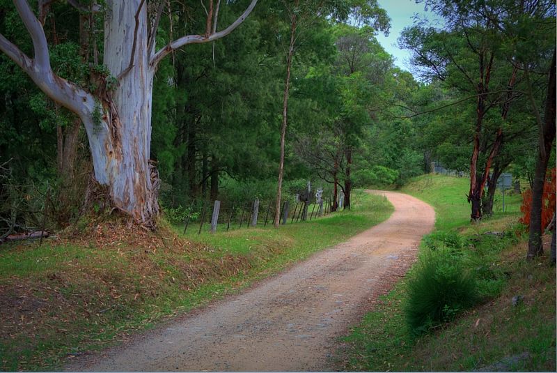
Here is a post with some shots of my trip, done earlier this year with a bit of info about the condition of the Majors Creek Araluen Road and past Araluen, on the Deua River section. I kept on the Araluen Road to Moruya ... viewtopic.php?f=2&t=60626" onclick="window.open(this.href);return false;
If you take Wicked Rides Tinderry Route? ... here is a bit about the Tinderrys from some stuff that I've also done over the last couple of years ... viewtopic.php?f=54&t=49591" onclick="window.open(this.href);return false;
Any questions? if I can answer them, please post them by tomorrow early evening (Tuesday 21st) ... I'll be riding to New England and back from Canberra, starting on Wednesday to enjoy winter on the Great Divide. I might not enjoy the many river crossings though. You can keep your eye on the Deua River, followings the BOMs prediction of a 70% increase in rain fall, above normal, over Winter ... http://waterinfo.nsw.gov.au/water.shtml ... 3&rskm_url" onclick="window.open(this.href);return false; ... (Rivers and Streams, Real Time Data, #217 - for the Moruya River Basin).
Some of the side creeks like Baines Gully, can obviously have their moments.

Deua Woila nocturn. A quite reach on the Deua, not far upstream of the National Park's camping ground, about 20 kilometres SE of Araluen.
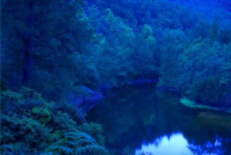
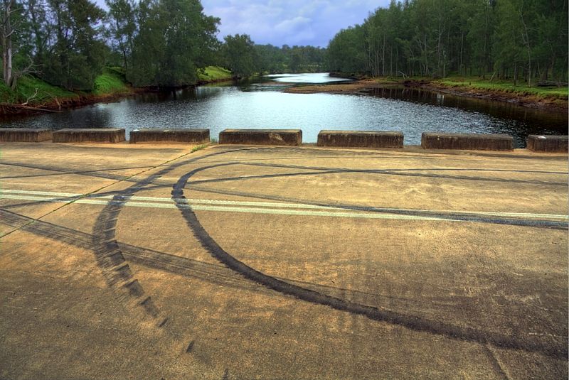
The Deua becomes the Moruya River at Kiora Bridge. A shot for consummate Pirelliologists. Pirelliology is a fine art.
Warren.
Their 23/1/09 trip, is a first class route. The back roads (like Plains Road) and the fire trails through Tallaganda are excellent. The Wicked Rides trip left Araluen Road at Knowles Road, to eventually, take on the single track called the Angry Doctor.
Here is a post with some shots of my trip, done earlier this year with a bit of info about the condition of the Majors Creek Araluen Road and past Araluen, on the Deua River section. I kept on the Araluen Road to Moruya ... viewtopic.php?f=2&t=60626" onclick="window.open(this.href);return false;
If you take Wicked Rides Tinderry Route? ... here is a bit about the Tinderrys from some stuff that I've also done over the last couple of years ... viewtopic.php?f=54&t=49591" onclick="window.open(this.href);return false;
Any questions? if I can answer them, please post them by tomorrow early evening (Tuesday 21st) ... I'll be riding to New England and back from Canberra, starting on Wednesday to enjoy winter on the Great Divide. I might not enjoy the many river crossings though. You can keep your eye on the Deua River, followings the BOMs prediction of a 70% increase in rain fall, above normal, over Winter ... http://waterinfo.nsw.gov.au/water.shtml ... 3&rskm_url" onclick="window.open(this.href);return false; ... (Rivers and Streams, Real Time Data, #217 - for the Moruya River Basin).
Some of the side creeks like Baines Gully, can obviously have their moments.
Deua Woila nocturn. A quite reach on the Deua, not far upstream of the National Park's camping ground, about 20 kilometres SE of Araluen.
The Deua becomes the Moruya River at Kiora Bridge. A shot for consummate Pirelliologists. Pirelliology is a fine art.
Warren.
"But on steep descending...Larson TT have bad effect on the mind of a rider" - MadRider from Suji, Korea 2001.
"Paved roads ... another fine example of wasteful government spending." - a bumper sticker.
"Paved roads ... another fine example of wasteful government spending." - a bumper sticker.
-
PRKLCD
- Posts: 10
- Joined: Wed May 15, 2013 2:45 pm
Re: Canberra to the coast
Thanks for the reply Warren - you're a champion, that's what I was looking for.
You're right, that first ride looks the best, that's the one I am going to take ( Araluen road the whole way ).
I am presuming this will be doable on a cyclecross bike ( Kona jake the snake).
Thanks heaps for that!
You're right, that first ride looks the best, that's the one I am going to take ( Araluen road the whole way ).
I am presuming this will be doable on a cyclecross bike ( Kona jake the snake).
Thanks heaps for that!
-
WarrenH
- Posts: 664
- Joined: Fri May 28, 2010 3:58 am
Re: Canberra to the coast
PRKLCD, you're welcome. It's raining North of Canberra right on the route I'm intending to take beside the Cullarin Range to Crookwell and big storms are blowing in from Binalong. It is good to be inside today looking at the BOMs dopplar radar. East Coast lows are my least favourite touring conditions. I'll wait.
Back to the route. Apart from climbing from Rossi to the top of the Gourock Range with the highest point at 1140m on the Main Range Forest Road on the top of the ridge, the rest of the time is basically undulating or downhill. The Gourock Range is the Great Dividing Range. The climb leaving Queanbeyan is a crazy start and climbing to Wallaces Gap after crossing the Shoalhaven River are about the only others, that will slow you down.
Where Harolds Cross Road becomes Vernalli Road (about 100m past the farm gate of Top Vernalli) the turn to the right that takes you to the Captains Flat Road is shown as Harolds Cross Road on Google Map but it is actually called Parlour Creek Road. Just in case you weren't expecting it ... not knowing how you're navigating the route, it might pay to know.
When you come down Parlour Creek Road at the junction with Captains Flat Road ... the view is brilliant.
"I am presuming this will be doable on a cyclecross bike", with back roads like this, probably. How will you carry your gear? I don't know CX bikes or how they can be fitted out for touring. I just know that they go fast, like it rough and get carried a lot by their riders.
Warren.
"But on steep descending...Larson TT have bad effect on the mind of a rider" - MadRider from Suji, Korea 2001.
"Paved roads ... another fine example of wasteful government spending." - a bumper sticker.
"Paved roads ... another fine example of wasteful government spending." - a bumper sticker.
-
rogergurr
- Posts: 21
- Joined: Sun May 06, 2012 7:52 pm
Re: Canberra to the coast
These posts have got me seriously thinking about a Canberra to Moruya 29er ride during summer (maybe Xmas/NewYear break?). Good old Google Maps with its "bicycling" option comes up with a 152km route that sounds similar to what you guys are describing!
Any thoughts/hints and things to look out for? Heat could no doubt be one of them I guess
Any thoughts/hints and things to look out for? Heat could no doubt be one of them I guess
-
PRKLCD
- Posts: 10
- Joined: Wed May 15, 2013 2:45 pm
Re: Canberra to the coast
Thanks for the tip Warren - very useful.
I wouldn't be touring so to speak, would back very lightly and it would only be a one way trip ( Wife will meet me at the other end, stay the night and drive back to Canberra ) I might even stay the night at the pub half way if we don't decided to do the trip in one day. Probably looking at undertaking this is September with a view to doing it a couple of times over summer for fun.
Hope the trip is going well
Who is online
Users browsing this forum: No registered users